 Demo Catalogue powered by geOrchestra
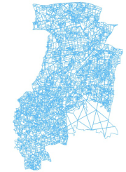
Bocage (Pleine-fougères, zone A, 2000) - Zone Atelier Armorique ZAAr
Cadre: Carte du bocage au point d'observation A du site de Pleine-fougères (Zone Atelier Armorique) en 2000
Programme: ECCO PNBC
Date du vol: 21/05/2000
Simple
- Date (Creation)
- 2007-09-06
- Citation identifier
- https://www.osuris.fr/geonetwork/srv/metadata/fc048189-9e6f-41f5-bfd3-f5820e155262
- Status
- Completed
- Point of contact
-
Organisation name Individual name Electronic mail address Role LETG-RENNES UMR 6554 CNRS Université de Rennes 2
Jean Nabucet
Author
- Maintenance and update frequency
- Not planned
-
GEMET
-
-
informations géoréférencées
-
bocage
-
-
theme.thesaurus_costel.rdf
-
theme.EnvironnementFR.rdf
-
-
Sols
-
Aménagement du territoire
-
Paysages et sites
-
- Use limitation
-
Aucune condition ne s’applique
- Access constraints
- License
- Use constraints
- License
- Spatial representation type
- Vector
- Distance
- 100 m
- Language
-
fre
- Character set
- UTF8
- Topic category
-
- Imagery base maps earth cover
- Description
-
France, Fougères, site de Pleine Fougères
))
))
- Distribution format
-
Name Version ESRI Shapefile
1.0
- OnLine resource
-
Protocol Linkage Name OGC:WMS
https://www.osuris.fr/geoserver/ecobio/wms PF_Haies_2000_PNBC
- Hierarchy level
- Dataset
Quantitative result
- Value type
- measure
- Value
- 1,5m
Conformance result
- Title
-
L’article 7, paragraphe 1, de la directive 2007/2/CE correspond aux modalités techniques de l’interopérabilité : il s’agit du règlement relatif à l’interopérabilité : règlement n°1253/2013 du 21 octobre 2013 modifiant et complétant le règlement n°1089/2010 du 23 novembre 2010.
- Date (Publication)
- 2013-10-21
- Pass
- Yes
- Statement
-
Donnée du bocage de la zone de pleine Fougères issu de la photo-interprétation de clichés aériens d'un ULM à partir du parcelle de la ZAA non conforme IGN (digitalisation à partir du Scan 25)
Metadata
- File identifier
- fc048189-9e6f-41f5-bfd3-f5820e155262 XML
- Metadata language
-
fre
- Character set
- UTF8
- Hierarchy level
- Dataset
- Hierarchy level name
-
Jeu de données
- Date stamp
- 2019-07-01T21:36:32
- Metadata standard name
-
ISO 19115
- Metadata standard version
-
1.0
- Metadata author
-
Organisation name Individual name Electronic mail address Role LETG-RENNES UMR 6554 CNRS Université de Rennes 2
Nabucet Jean
Distributor
Overviews

Spatial extent
),POLYGON((-1.5159837934638256%2048.42546914735706,-1.5159837934638256%2048.56915208211029,-1.6639817040944196%2048.56915208211029,-1.6639817040944196%2048.42546914735706,-1.5159837934638256%2048.42546914735706))))
Provided by
