 Demo Catalogue powered by geOrchestra
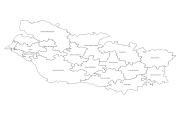
Service de visualisation cartographique (WMS) des communautés de communes de la Somme
Le Syndicat Mixte SOMME NUMERIQUE est un réseau public pour les communications numériques.
Simple
Identification info
- Date (Creation)
- 2017-02-07
- Citation identifier
- https://www.geo2france.fr/geonetwork/srv/fre/catalog.search#/metadata/fa720cfc-7c4e-4611-b72d-9fb70acb02f2
Point of contact
No information provided.
-
RÈGLEMENT (CE) No 1205/2008
-
-
infoMapAccessService
-
- Theme
-
-
Service d’accès aux cartes
-
wms 1.3.0
-
fibre
-
- Use limitation
-
Aucune condition ne s’applique
- Access constraints
- Other restrictions
- Other constraints
-
Pas de restriction d’accès public
- Service Type
- view
- Service Version
-
1.3.0
N
S
E
W
))
- Coupling Type
- Tight
- Contains Operations
-
Operation Name Distributed Computing Platforms Connect Point GetCapabilities
Web services http://www.sommenumerique.fr/cgi-bin/mapserv?map=/home/somnum/www/fileadmin/carte/map_files/ccmembres_L93.map&service=WMS&request=GetCapabilities&
- Distribution format
-
Name Version OGC:WMS
1.3.0
- OnLine resource
-
Protocol Linkage Name OGC:WMS-1.3.0-http-get-capabilities
http://www.sommenumerique.fr/cgi-bin/mapserv?map=/home/somnum/www/fileadmin/carte/map_files/ccmembres_L93.map&service=WMS&request=GetCapabilities& WWW:LINK-1.0-http--link
https://www.geo2france.fr/geonetwork/srv/fre/catalog.search#/metadata/fa720cfc-7c4e-4611-b72d-9fb70acb02f2 Lien vers la fiche de métadonnées d'origine
- Hierarchy level
- Service
- Other
-
Service de visualisation WMS
Conformance result
- Date (Publication)
- 2009-10-19
- Explanation
-
Conformité non evaluée
- Pass
Metadata
- File identifier
- fa720cfc-7c4e-4611-b72d-9fb70acb02f2 XML
- Metadata language
- Français
- Character set
- UTF8
- Hierarchy level
- Service
- Hierarchy level name
-
Service de visualisation WMS
- Date stamp
- 2019-06-26T14:35:47
- Metadata standard name
-
ISO 19119/2005
- Metadata standard version
-
1.0
Metadata author
No information provided.
Overviews
thumbnail

large_thumbnail
Spatial extent
N
S
E
W
Provided by

Associated resources
Not available