 Demo Catalogue powered by geOrchestra
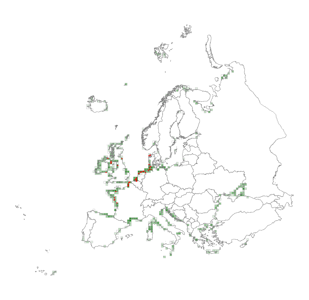
EUNIS Littoral biogenic habitat types (salt marshes), distribution based on vegetation plot data - version 1, Nov. 2021
This metadata corresponds to the EUNIS Littoral biogenic habitat types (salt marshes), distribution based on vegetation plot data dataset.
Littoral biogenic habitats (commonly known as salt marshes) are formed by animals such as worms and mussels or plants.
The verified saltmarsh habitat samples used are derived from the Braun-Blanquet database ( http://www.sci.muni.cz/botany/vegsci/braun_blanquet.php?lang=en ) which is a centralised database of vegetation plots and comprises copies of national and regional databases using a unified taxonomic reference database. The geographic extent of the distribution data are all European countries except Armenia and Azerbaijan. The dataset is provided both in Geodatabase and Geopackage formats.
Simple
- Date (Publication)
- 2021-11-15
- Date (Creation)
- 2019-03-01
- Edition
-
01.00
- Citation identifier
- eea_v_3035_10_mio_eunis-hab-m_p_1940-2020_v01_r00
- Citation identifier
- DAT-137-en
- Point of contact
-
Organisation name Individual name Electronic mail address Role European Environment Agency
Point of contact European Environment Agency
Custodian
Point of contact
Point of contact
- Maintenance and update frequency
- Not planned
-
GEMET - INSPIRE themes, version 1.0
-
-
Habitats and biotopes
-
- Keywords
-
- Keywords
-
-
GEMET
-
-
salt marsh
-
habitat
-
natural area
-
terrestrial ecosystem
-
-
Continents, countries, sea regions of the world.
-
-
Belarus
-
Moldova
-
Georgia
-
San Marino
-
Andorra
-
Russian Federation (European part)
-
Monaco
-
Ukraine
-
EEA38 (from 2020)
-
United Kingdom
-
-
EEA topics
-
-
Biodiversity
-
-
EEA Management Plan
-
-
2021 1.1.4
-
-
Sous-regions marines
-
-
/Métropole
-
/Métropole/Manche mer du Nord
-
/Métropole/Mers Celtiques
-
/Métropole/Golfe de Gascogne
-
/Métropole/Méditerranée occidentale
-
-
Thématiques - SIMM
-
-
/Etat du Milieu/Habitats
-
-
Type de jeux de donnée - ODATIS
-
-
/Données dérivées/Produits composites
-
- Access constraints
- Other restrictions
- Other constraints
- no limitations to public access
- Use constraints
- Other restrictions
- Other constraints
-
EEA standard re-use policy: unless otherwise indicated, re-use of content on the EEA website for commercial or non-commercial purposes is permitted free of charge, provided that the source is acknowledged ( https://www.eea.europa.eu/legal/copyright ). Copyright holder: European Environment Agency (EEA).
- Spatial representation type
- Vector
- Denominator
- 10000000
- Language
- English
- Topic category
-
- Biota
))
- Begin date
- 1940-01-01
- End date
- 2017-12-31
- Unique resource identifier
- EPSG:3035
- Distribution format
-
Name Version Geopackage
1
GDB
- OnLine resource
-
Protocol Linkage Name EEA:FOLDERPATH
https://sdi.eea.europa.eu/webdav/datastore/public/eea_v_3035_10_mio_eunis-hab-m_p_1940-2020_v01_r00/ WWW:URL
https://sdi.eea.europa.eu/data/f626c353-fff5-410c-84f1-1cf48951f4af Direct download
ESRI:REST
https://bio.discomap.eea.europa.eu/arcgis/rest/services/EUNIS/Saltmarshes_Distribution_point/MapServer Vegetation Plot Layer
OGC:WMS
https://bio.discomap.eea.europa.eu/arcgis/services/EUNIS/Saltmarshes_Distribution_point/MapServer/WMSServer?request=GetCapabilities&service=WMS WWW:URL
https://sdi.eea.europa.eu/data/f5946d76-bf09-4261-8f2e-6218210ae3af EUNIS documentation for habitat classification
- Hierarchy level
- Dataset
Conformance result
- Date (Publication)
- 2010-12-08
- Explanation
-
See the referenced specification
- Statement
-
The database compiled for the Braun-Blanquet project comprises various national and regional vegetation databases. The maintenance of these databases is in principle in the hands of the custodians. However, before uploading datasets into the Braun-Blanquet database a quality check is performed by WENR and Masaryk University. If possible, detected errors are corrected and reported back to the data provider. Attributes added to the distribution data are: YEAR (year of recording) and PRECISION (precision in meters, indicating how precise the location is indicated).
More information on the generation of the spatial files is provided in the documents available for download together with the dataset.
Metadata
- File identifier
- f626c353-fff5-410c-84f1-1cf48951f4af XML
- Metadata language
- English
- Character set
- UTF8
- Hierarchy level
- Dataset
- Date stamp
- 2024-05-22T13:21:31.409553Z
- Metadata standard name
-
ISO 19115:2003/19139
- Metadata standard version
-
1.0
- Metadata author
-
Organisation name Individual name Electronic mail address Role European Environment Agency
Point of contact
Overviews
Spatial extent
Provided by
