 Demo Catalogue powered by geOrchestra
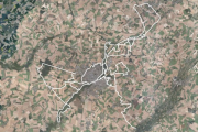
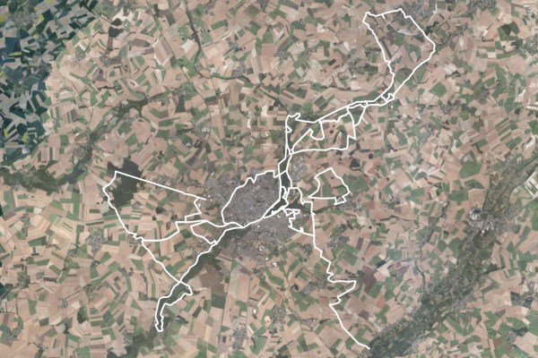
Chemins de randonnée du Saint-Quentinois
Tracé des différents chemins de randonnée du Saint-Quentinois.
Simple
- Date (Creation)
- 2013-12-03
- Date (Publication)
- 2013-12-04
- Date (Revision)
- 2015-06-23
- Citation identifier
- http://saint-quentin-numerique.fr/Chemins-randonnees
Point of contact
Point of contact
Point of contact
- Theme
-
-
chemins
-
GR
-
-
GEMET - Concepts, version 2.4
-
-
sentier de randonnée
-
sport
-
-
Communes
-
-
SAINT-QUENTIN (02691)
-
- Use limitation
-
Licence Ouverte 1.0 d'octobre 2011 (cf. http://wiki.data.gouv.fr/images/9/9d/Licence_Ouverte.pdf )
- Access constraints
- Other restrictions
- Use constraints
- License
- Other constraints
-
Pas de restriction d’accès public
- Spatial representation type
- Vector
- Denominator
- 5000
- Language
- Français
- Character set
- UTF8
- Topic category
-
- Transportation
- Description
-
CA de Saint-Quentin
))
- Reference system identifier
- http://www.opengis.net/def/crs/EPSG/0/2154
- OnLine resource
-
Protocol Linkage Name WWW:LINK-1.0-http--link
http://saint-quentin-numerique.fr/Chemins-de-randonnee Portail Open Data de Saint-Quentin
WWW:LINK-1.0-http--link
http://saint-quentin-numerique.fr/IMG/kml/sentiers_randonnees.kml Lien de téléchargement des données au format KML WWW:LINK-1.0-http--link
http://saint-quentin-numerique.fr/IMG/zip/sentiers_randonnees_juin2015.zip Lien de téléchargement des données au format ZIP WWW:LINK-1.0-http--link
http://www.arcgis.com/home/webmap/viewer.html?layers=2d5f5940b8ed4ccb89b0da643789c336 Carte interactive sur ArcGIS.com
Adresse du service REST d'ArcGIS.com
https://services1.arcgis.com/5nIW6mZeb2YNJ7np/arcgis/rest/services/ENV_RANDONNEE/FeatureServer/0 Adresse du service REST d'ArcGIS.com
WWW:LINK-1.0-http--link
https://www.geo2france.fr/geonetwork/srv/fre/catalog.search#/metadata/ebf4d580-bac2-452d-a719-f6acd2cdf5ff Lien vers la fiche de métadonnées d'origine
- Hierarchy level
- Dataset
Conformance result
- Date (Publication)
- 2010-11-23
- Explanation
-
Non Evalué
- Statement
-
Données produites par la Communauté d'agglomération de Saint-Quentin
Metadata
- File identifier
- ebf4d580-bac2-452d-a719-f6acd2cdf5ff XML
- Metadata language
- Français
- Character set
- UTF8
- Hierarchy level
- Dataset
- Date stamp
- 2019-06-26T14:34:14
- Metadata standard name
-
ISO 19115:2003/19139
- Metadata standard version
-
1.0
Metadata author
Overviews
Spatial extent
Provided by
