 Demo Catalogue powered by geOrchestra
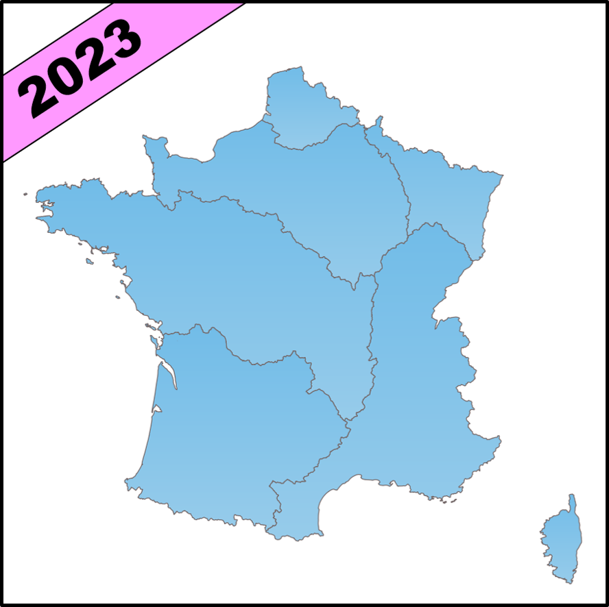
Bassins hydrographiques - Métropole 2023 - BD Topage®
Jeu de données des bassins hydrographiques de France métropolitaine BD Topage® version 2023
La France est découpée en 12 grands bassins versants, dénommés circonscription hydrographique de bassin. Il s’agit :
- du bassin Artois-Picardie,
- du bassin Rhin-Meuse,
- du bassin Seine-Normandie,
- du bassin Loire-Bretagne,
- du bassin Adour-Garonne.
- du bassin Rhône-Méditerranée,
- du bassin Corse,
- du bassin Guadeloupe,
- du bassin Martinique,
- du bassin Guyane,
- du bassin Réunion,
- du bassin Mayotte
Les limites hydrographiques de bassin ne correspondent pas aux limites administratives.
Simple
- Date (Publication)
- 2023-04-05
- Edition
-
2023
- Citation identifier
- http://www.sandre.eaufrance.fr/?urn=urn:sandre:donnees:BassinHydrographique:FXX:::ressource:2023:topage:1:html
- Presentation form
- Digital map
- Name
-
BD Topage 2023
- Status
- Completed
- Point of contact
-
Organisation name Individual name Electronic mail address Role Institut national de l’information géographique et forestière (IGN)
Custodian Office Français de la Biodiversité (OFB) - Information Géographique sur l'Eau
Custodian
- Maintenance and update frequency
- Annually
- Metadata author
-
Organisation name Individual name Electronic mail address Role SANDRE
Custodian
- Theme
-
-
eaux de surface
-
BD Topage
-
hvd
-
- Place
-
-
métropole
-
france
-
-
High-value dataset categories
-
-
Observation de la terre et environnement
-
- Use limitation
-
Données ouvertes
- Access constraints
- Other restrictions
- Other constraints
- Pas de restriction d’accès public
- Use constraints
- Other restrictions
- Other constraints
-
Licence Ouverte 2.0
https://www.etalab.gouv.fr/wp-content/uploads/2017/04/ETALAB-Licence-Ouverte-v2.0.pdf
- Spatial representation type
- Vector
- Denominator
- 50000
- Denominator
- 100000
- Distance
- 10 m
- Language
- Français
- Character set
- UTF8
- Topic category
-
- Inland waters
))
- Topology level
- Geometry only
- Geometric object type
- Curve
- Distribution format
-
Name Version ESRI Shapefile
inapplicable
GeoJSON
inapplicable
OGC GeoPackage
inapplicable
- OnLine resource
-
Protocol Linkage Name WWW:LINK-1.0-http--related https://id.eaufrance.fr/ddd/ETH/2.1/BassinHydrographique Consulter le dictionnaire interactif en ligne
WWW:LINK-1.0-http--link https://www.sandre.eaufrance.fr/ftp/documents/fr/scn/topage/2.1/sandre_scenario_geo_topage_v2.1.pdf Consulter le scénario d'échange géographique du référentiel hydrographique 2023
WWW:LINK-1.0-http--link
https://www.sandre.eaufrance.fr/ftp/documents/fr/pre/eth/1/sandre_pres_eth_1.pdf Consulter le document de présentation
WWW:LINK-1.0-http--related
https://mdm.sandre.eaufrance.fr/geo/rapportsv3/rapport/2380 Consulter le rapport de contrôles en ligne
OGC:WMS
https://services.sandre.eaufrance.fr/geo/topage2023? BassinHydrographique_FXX_Topage2023
OGC:WFS
https://services.sandre.eaufrance.fr/geo/topage2023? sa:BassinHydrographique_FXX_Topage2023
WWW:DOWNLOAD-1.0-http--download
https://services.sandre.eaufrance.fr/telechargement/geo/ETH/BDTopage/2023/BassinHydrographique/BassinHydrographique_FXX-shp.zip Télécharger les bassins hydrographiques métropole - Format ESRI Shapefile
WWW:DOWNLOAD-1.0-http--download
https://services.sandre.eaufrance.fr/telechargement/geo/ETH/BDTopage/2023/BassinHydrographique/BassinHydrographique_FXX-gpkg.zip Télécharger les bassins hydrographiques métropole - Format GPKG
WWW:DOWNLOAD-1.0-http--download
https://services.sandre.eaufrance.fr/telechargement/geo/ETH/BDTopage/2023/BassinHydrographique/BassinHydrographique_FXX-geojson.zip Télécharger les bassins hydrographiques métropole - Format GeoJSON
WWW:LINK-1.0-http--partners
https://espacecollaboratif.ign.fr Participer à la mise à jour collaborative de la BD Topage®
- Hierarchy level
- Dataset
Domain consistency
- Name of measure
-
Conceptual schema compliance
- Name of measure
-
Value domain conformance
- Date / Time
- 2020-04-28T00:00:00
Conformance result
- Date (Creation)
- 2019-02-05
- Citation identifier
- urn:sandre:scenario-d-echanges-geographique:topage:FRA :::ressource:1:::
- Cited responsible party
-
Organisation name Individual name Electronic mail address Role SANDRE
Author
- Pass
- Yes
Conformance result
- Date (Publication)
- 2010-12-08
- Pass
- No
Conformance result
- Date (Publication)
- 2010-11-23
- Edition date
- 2014-04-17
- Pass
- No
- Statement
-
Les bassins hydrographiques BD TOPAGE® sont obtenus par union des bassins versant topographiques BD TOPAGE® (Moyenne échelle) associés au même code de bassin hydrographique.
Metadata
- File identifier
- d6db36ef-f056-488a-9d82-d8f2d8a6cbab XML
- Metadata language
- Français
- Character set
- UTF8
- Hierarchy level
- Dataset
- Date stamp
- 2024-05-24T09:01:58.11Z
- Metadata standard name
-
ISO 19115:2003/19139
- Metadata standard version
-
1.0
- Metadata author
-
Organisation name Individual name Electronic mail address Role SANDRE
Point of contact
Overviews
Spatial extent
Provided by
