 Demo Catalogue powered by geOrchestra
Niveaux Piezometrique (Sougeal, 2017) - Zone Atelier Armorique ZAAr
Niveaux d'eau dans divers compartiments du marais de sougeal.
Mesures automatique horaire, temps UTC, hauteur NGF, température de l'eau à 2m sous le sol
Type de sonde : sonde Divers
Précision :+/- 2 cm et 0.1°c
https://www.vanessen.com/products/water-level/td-diver
Releves trimestriels environ
Simple
- Date (Creation)
- 2016-10-26T10:00:00
- Citation identifier
- https://www.osuris.fr/geonetwork/srv/metadata/c34f8a48-af6d-49ec-abf2-8fe5d786b68c
- Purpose
-
Corréler niveau d'eau mesurés in-situ et relevés satellitaires et LIDAR
Avoir une meilleurs connaissance de la ressource hydrique du marais
- Status
- On going
- Point of contact
-
Organisation name Individual name Electronic mail address Role ECOBIO UMR 6553 CNRS Université de Rennes 1
Cendrine Mony
Point of contact
- Maintenance and update frequency
- As needed
- Metadata author
-
Organisation name Individual name Electronic mail address Role UMS3343 - OSUR
Bouger Guillaume
Custodian ECOBIO UMR 6553 CNRS Université de Rennes 1
Jambon Olivier
Point of contact
- Temporal
-
-
Nieaux piézométriques
-
Température
-
Niveaux NGF
-
- Place
-
-
Zone Atelier Armorique ZAAr
-
-
GEMET - INSPIRE themes, version 1.0
-
-
Installations de suivi environnemental
-
- Use limitation
-
Usage libre sous réserve des mentions obligatoires sur tout document de diffusion : "Source : {Unité de recherche}""
- Use limitation
-
Licence ouverte : https://www.etalab.gouv.fr/licence-ouverte-open-licence
- Access constraints
- Other restrictions
- Use constraints
- License
- Other constraints
-
Pas de restriction d’accès public
- Spatial representation type
- Vector
- Denominator
- 1
- Language
- Français
- Character set
- UTF8
- Topic category
-
- Environment
- Inland waters
- Climatology, meteorology, atmosphere
))
- Begin date
- 2016-10-26
- End date
- 2016-10-26
- Reference system identifier
- EPSG / RGF93 / Lambert-93 (EPSG:2154)
- Distribution format
-
Name Version ESRI Shapefile
{version si connue}
- Distributor contact
-
Organisation name Individual name Electronic mail address Role OSUR
Point of contact
- OnLine resource
-
Protocol Linkage Name OGC:WMS-1.3.0-http-get-map
https://www.osuris.fr/geoserver/zaar/wms piezo_sougeal_DGPS
- Hierarchy level
- Dataset
Conformance result
- Date (Publication)
- 2018-06-29
- Explanation
-
{conformité}
- Pass
- Yes
- Statement
-
Relevés automatiques par sondes
Metadata
- File identifier
- c34f8a48-af6d-49ec-abf2-8fe5d786b68c XML
- Metadata language
- Français
- Character set
- UTF8
- Hierarchy level
- Dataset
- Hierarchy level
- Dataset
- Date stamp
- 2018-10-24T10:43:57
- Metadata standard name
-
ISO 19115:2003/19139
- Metadata standard version
-
1.0
- Metadata author
-
Organisation name Individual name Electronic mail address Role UMS3343 - OSUR
BOUGER Guillaume
Point of contact
Overviews
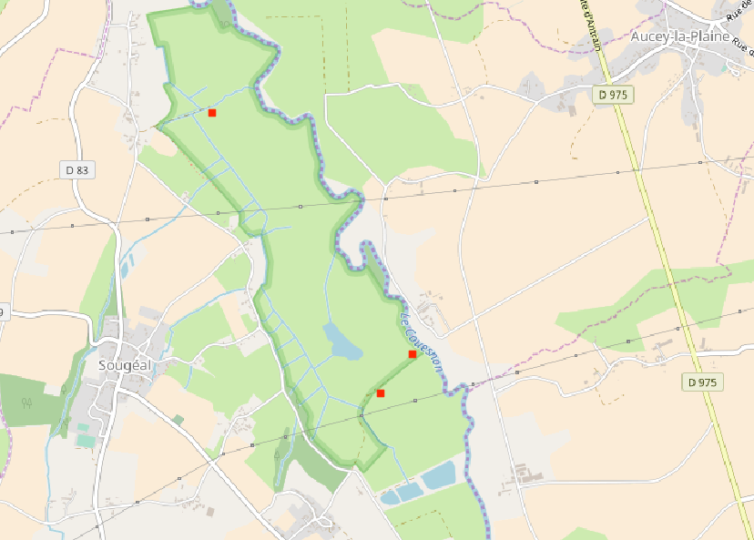
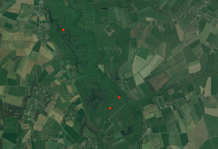
Spatial extent
Provided by
