 Demo Catalogue powered by geOrchestra
Boundaries of Issued Use of Private Maritime Space Securities for Research
Boundaries of Issued Use of Private Maritime Space Securities for Research. The issue of Use of Private Maritime Space Securities, in accordance with the procedures established by Decree-Law 38/2015 of 12 March, whose competence is assigned to the Direção-Geral dos Recursos Naturais, Segurança e Serviços Marítimos by the Article 2th point p) Decree-Law No. 49-A / 2012 of 29 February, arises from the Maritime Spatial Planning Basic Law, Law 17/2014 of 10 April.
Simple
- Date (Revision)
- 2017-03-14
- Date (Creation)
- 2015-03-12
- Citation identifier
- bef8a6f8-8763-4f72-ab09-5016542b51d8
- Status
- Under development
- Point of contact
-
Organisation name Individual name Electronic mail address Role Direção-Geral de Recursos Naturais, Segurança e Serviços Marítimos (DGRM)
Elisabete Dias
Point of contact
- Maintenance and update frequency
- Continual
-
GEMET - INSPIRE themes, version 1.0
-
-
Zonas de gestão/restrição/regulamentação e unidades de referência
-
-
Thesaurus SNIMar v.1.0
-
-
Plano de Ordenamento do Espaço Marítimo (POEM)
-
-
Thesaurus SNIMar v.1.0
-
-
Ordenamento e Gestão do Espaço Marítimo
-
- Keywords
-
-
DGRM
-
- Use limitation
-
Sem Limitações
- Access constraints
- Other restrictions
- Use constraints
- Other restrictions
- Other constraints
-
Sem restrições de acesso ou uso
- Classification
- Unclassified
- Spatial representation type
- Vector
- Denominator
- 1
- Language
- Portuguese
- Character set
- UTF8
- Topic category
-
- Planning cadastre
- Oceans
))
- Reference system identifier
- EPSG / http://www.opengis.net/def/crs/EPSG/0/4326
- Distribution format
-
Name Version SHP
v1.1
- Distributor contact
-
Organisation name Individual name Electronic mail address Role Direção-Geral de Recursos Naturais, Segurança e Serviços Marítimos (DGRM)
Elisabete Dias
Distributor
- OnLine resource
- Hierarchy level
- Dataset
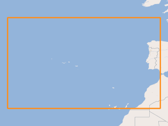
Extent
- Dataset
-
bef8a6f8-8763-4f72-ab09-5016542b51d8
Conformance result
- Date (Publication)
- 2010-12-08
- Explanation
-
Ver a especificação citada.
- Pass
- Yes
- Statement
-
O conjunto de dados geográficos é obtido por compilação dos elementos obrigatoriamente apresentados pelos requerentes aquando do pedido.
Metadata
- File identifier
- c34a9d44-1067-47fe-94bc-b57a12c6ffaf XML
- Metadata language
- Portuguese
- Character set
- UTF8
- Hierarchy level
- Dataset
- Date stamp
- 2017-04-13
- Metadata standard name
-
Perfil SNIMar
- Metadata standard version
-
v.0.9.3
- Metadata author
-
Organisation name Individual name Electronic mail address Role Direção-Geral de Recursos Naturais, Segurança e Serviços Marítimos (DGRM)
Elisabete Dias
Point of contact
- Other language
-
Language Character encoding English UTF8
Overviews

Spatial extent
Provided by
