 Demo Catalogue powered by geOrchestra
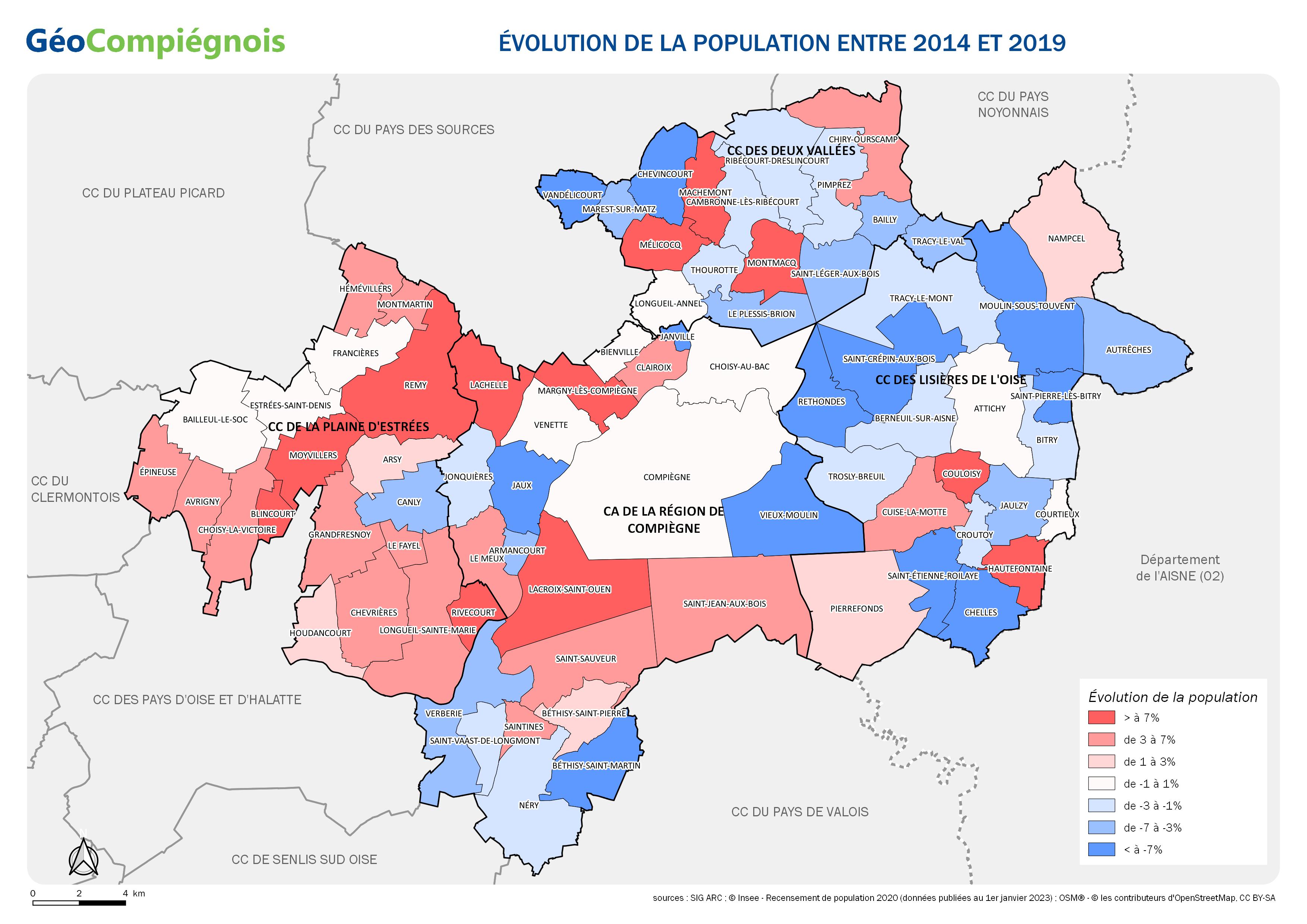
Evolution de la population des communes du Grand Compiégnois
Carte montrant l'évolution de la population municipale des communes sur le territoire du Grand Compiégnois entre 2016 et 2021. Données issues de l'Insee publiées au 1er janvier 2024. Cette carte ne prend pas en compte la période de transition dû au non recensement de l'année du COVID-19.
Simple
- Date (Creation)
- 2024-01-02T09:00:00
- Presentation form
- Digital map
Point of contact
No information provided.
-
GEMET - INSPIRE themes, version 1.0
-
-
Répartition de la population — démographie
-
-
GEMET - Concepts, version 2.4
-
-
carte
-
évolution démographique
-
-
Collectivités du Pays Compiégnois
-
-
Grand-Compiégnois
-
- Use constraints
- Copyright
- Use limitation
-
Utilisation libre sous réserve de mentionner la source (a minima le nom du producteur) et la date de sa dernière mise à jour
- Denominator
- 200000
- Language
- Français
- Topic category
-
- Society
- Description
-
Grand-Compiégnois
N
S
E
W
))
- Codespace
-
EPSG
- Version
-
7.9
- Distribution format
-
Name Version
- OnLine resource
-
Protocol Linkage Name WWW:LINK-1.0-http--link
http://geo.compiegnois.fr/documents/cartotheque/GRDC_carte_evolution_population.jpg Carte sur l'évolution de la population entre 2016 et 2021
Conformance result
- Date (Publication)
Metadata
- File identifier
- b6c1e44e-09d1-4ad3-912c-b7ba8c31e44d XML
- Metadata language
- Français
- Character set
- UTF8
- Hierarchy level
- Map
- Date stamp
- 2024-01-02T12:27:48
- Metadata standard name
-
ISO 19115:2003/19139
- Metadata standard version
-
1.0
Metadata author
No information provided.
Overviews
Spatial extent
N
S
E
W
Provided by

Associated resources
Not available