 Demo Catalogue powered by geOrchestra
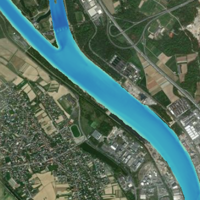
Digital terrain model for the river Rhine for an area of interest
This data provides the absolute altitudes of the Rhine river bed. This information has been generated on the basis of bathymetric and aerial surveys. It is currently available for the area of specific interest (AOI) delimited by kilometre stones 170 and 180. The resolution of this raster file is 1m. Do not use for navigation !
Simple
- Date (Creation)
- 2023-07-10
- Date (Publication)
- 2023-08-28
- Citation identifier
- AOI_dem_rhin
- Status
- Completed
- Point of contact
-
Organisation name Individual name Electronic mail address Role GeoRhena
GeoRhena
Point of contact Bundesanstalt für Gewässerkundeg
BfG
Custodian Wasserstraßen- und Schifffahrtsverwaltung des Bundes
WSV
Owner
- Maintenance and update frequency
- Not planned
- Keywords
-
-
Upper Rhine
-
River
-
Bathymetry
-
channel
-
relief
-
-
GEMET - Concepts, version 2.4
-
-
relief (land)
-
river
-
river channelling
-
- Use limitation
-
CC BY Licence
- Access constraints
- Other restrictions
- Use constraints
- Other restrictions
- Other constraints
-
No other limitation ; GeoNutzV §2 and §3 , GeoZG
- Spatial representation type
- Grid
- Denominator
- 1
- Language
- Français
- Character set
- UTF8
- Topic category
-
- Inland waters
- Begin date
- 2003-01-01
- End date
- 2010-12-31
))
- Distribution format
-
Name Version Raster Geodata
-
- OnLine resource
-
Protocol Linkage Name OGC:WMS
https://geoportal.georhena.eu/geoserver/environment/ows AOI_dem_rhin
- Hierarchy level
- Dataset
- Statement
-
The original data was supplied by the BFG (manager) and is the property of the WSV (owner). They were in .xyz format and covered an area slightly larger than that of the Rhine. GeoRhena carried out the following processing: assembly, cutting, reprojection and creation of a digital elevation model.
Please note: the original height reference system is now obsolete. It is DHHN92.
With thanks to the Wasserstraßen- und Schifffahrtsverwaltung and the Bundesanstalt für Gewässerkunde.
Metadata
- File identifier
- a549b16c-e8a2-40df-9fce-f43ad2ca945a XML
- Metadata language
- Français
- Character set
- UTF8
- Hierarchy level
- Dataset
- Date stamp
- 2023-08-29T08:17:27.0046Z
- Metadata standard name
-
ISO 19115:2003/19139
- Metadata standard version
-
1.0
- Metadata author
-
Organisation name Individual name Electronic mail address Role GeoRhena: Geographical Information System of the Upper Rhine
Point of contact
- Other language
-
Language Character encoding German UTF8 English UTF8 French UTF8
)))
