 Demo Catalogue powered by geOrchestra
Radars HF
High-frequency (HF) radars
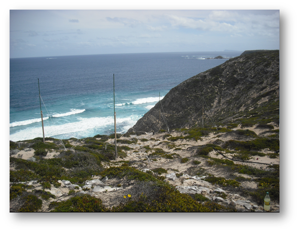
Observation des courants de surface par radars HF. Ce système de radars HF de permet de dresser, en continu et sur de longues périodes, les cartes des courants marins de surface, jusqu'à 100km et avec une résolution spatiale de 3km.
Observation of surface currents by HF radars. This system of HF radars makes it possible to compile, continuously and over long periods, maps of surface marine currents, up to 100km and with a spatial resolution of 3km.
Simple
-
Date (Creation)Date (Création)
- 2009-01-01
-
Reconnaissance
-
Université Toulon, CORIOLIS Côtier, Shom
- Point of contact
-
Organisation name Individual name Electronic mail address Role Shom
Valérie Cariou
Point of contactPoint de contactIFREMER
Louis Marie
Point of contactPoint de contactUniversité de Toulon
Céline Quentin
Point of contactPoint de contactIFREMER
Charria Guillaume
Point of contactPoint de contact
- Keywords
-
-
Direction et intensité du courant
-
-
Centre de données ODATIS
-
-
CDS-IS-Shom
CDS-IS-Shom
-
CDS-IS-CORIOLIS
CDS-IS-CORIOLIS
-
-
Type de jeux de donnée ODATIS
-
-
Données d'observation
Observational data
-
-
Thèmatiques ODATIS
-
-
Océanographie opérationnelle
Operational oceanography
-
Dispositifs d’observation pour la recherche
Observation system for research
-
-
Sous-regions marines
-
-
/Métropole
/Metropolitan France
-
/Métropole/Manche mer du Nord
/Metropolitan France/Channel-North Sea
-
/Métropole/Golfe de Gascogne
/Metropolitan France/Bay of Biscay
-
/Métropole/Mers Celtiques
/Metropolitan France/Celtic Seas
-
/Métropole/Méditerranée occidentale
/Metropolitan France/Western Mediterranean
-
-
Thématiques - SIMM
-
-
Recherche
Research
-
/Etat du Milieu/Hydrodynamique
/Environmental Status/Hydrodynamics
-
-
ODATIS aggregation parameters and Essential Variable names
-
-
Courants
Currents
-
-
Limitation d'utilisation
-
Aucune condition ne s’applique
-
Access constraintsContraintes d'accès
-
CopyrightDroit d’auteur / Droit moral (copyright)
-
Use constraintsContraintes d'utilisation
-
Other restrictionsAutres restrictions
-
Spatial representation typeType de représentation spatiale
-
VectorVecteur
-
LanguageLangue de la ressource
- Français
-
Character setEncodage des caractères
-
UTF8Utf8
-
Topic categoryCatégorie ISO
-
-
OceansOcéans
-
))
- Begin date
- 2009-01-01
-
Geometric object typeType de géométries des objets
-
CurveLigne
- Distribution format
-
Name Version
- OnLine resource
-
Protocol Linkage Name WWW:LINK
http://data.shom.fr Shom
WWW:LINK
http://www.coriolis-cotier.org/fr CORIOLIS Côtier
WWW:LINK-1.0-http--metadata-URL
https://doi.org/10.17183/hfr_iroise DOI du jeu de données
WWW:LINK
https://services.data.shom.fr/geonetwork/srv/fre/catalog.search#/metadata/RADARHF_OBS_R1110_IROISE_20210131.xml Plus d'information sur data.shom.fr
OGC:WMS
https://services.data.shom.fr/ncwms2/wms?service=WMS&request=GetCapabilities&version=1.3.0 HYDRODYN-MJ_HYCOM3D-MJ_R1000_MANGASC/salinity
-
Hierarchy levelNiveau
-
DatasetJeu de données
-
Généralités sur la provenanceStatement
-
La côte bretonne a été la première à être instrumentée pour un suivi en continu des courants et est équipée d’une paire de radar HF exploitée par le Shom. La façade méditerranéenne est équipée de 2 paires de radars autour de Toulon et de Nice, zones propices à l’étude du courant Liguro-Provençal. Ils sont exploitées par le CNRS et l’Université de Toulon. CORIOLIS Côtier: Radars Haute Fréquence
The Breton coast was the first to be provided with the instruments to monitor currents on a continuous basis and is equipped with a pair of HF radars operated by the Shom. The Mediterranean coast is equipped with 2 pairs of radars near Toulon and Nice - areas conducive to the study of the Liguro-Provençal current. They are operated by the CNRS and the University of Toulon. CORIOLIS Coastal: High-frequency Radars.
Metadata
-
File identifierIdentifiant de la fiche
- a2510e1d-d359-457e-8995-2e6ffac2db25 XML
-
Metadata languageLangue
- Français
-
Character setJeu de caractères
-
UTF8Utf8
-
Hierarchy levelType de ressource
-
DatasetJeu de données
-
Date stampDate des métadonnées
- 2024-06-13T13:35:11.928Z
- Metadata standard name
-
ISO 19115:2003/19139 - SEXTANT
- Metadata standard version
-
1.0
- Other language
-
Language Character encoding EnglishAnglaisUTF8Utf8FrenchFrançaisUTF8Utf8
)))
