 Demo Catalogue powered by geOrchestra
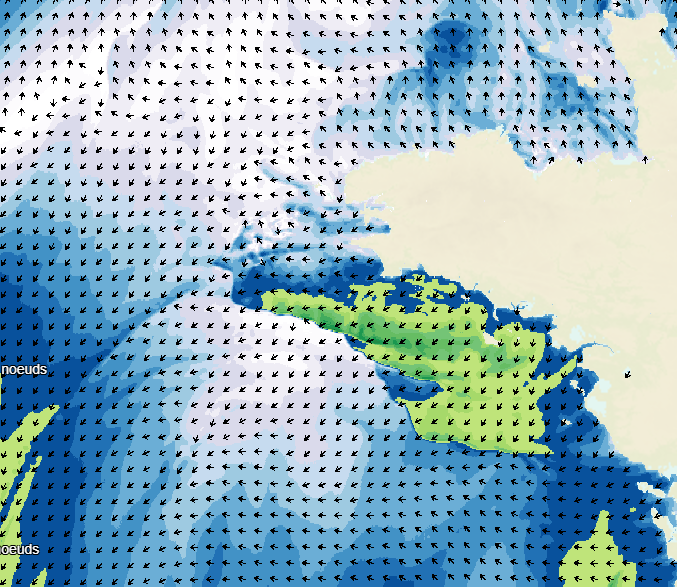
Weather forecasting digital model
Weather forecasting models are used to show atmospheric conditions by computing changes in meteorological parameters on a 3D atmospheric grid model. Physical laws are used to determine behaviour: fluid mechanics, variation in water phase, turbulence, radiation, and atmospheric interaction with space, the continents and the oceans. The initial conditions are determined by assimilating variational data including a large volume and wide variety of in situ observations obtained from remote detection systems.
The weather forecasts available on data.shom.fr only contain "wind at 10m" and "atmospheric pressure at sea level" parameters. A land/sea mask is then applied to exclude non-maritime forecasts. These forecasts are taken from 2 different types of models: ARPEGE for world and European scale input (0.5° to 0.1° resolution) and AROME for mainland France (1.3 km resolution).
ARPEGE is a global hydrostatic spectral model, with variable horizontal resolution (centred on France), vertical finite element modelling and hybrid vertical coordinates. ARPEGE is an integral part of the Arpège-IFS software package, designed, developed and maintained by Météo-France in cooperation with ECMWF (European Centre for Medium-Range Weather Forecasts - http://www.ecmwf.int/ ).
AROME is a non-hydrostatic spectral model for weather forecasts in mainland France, with finite difference modelling for vertical input and hybrid coordinates. AROME was developed by Météo-France thanks to close national (CNRS) and international (CEPMMT, Aladin, Hirlam) cooperation programmes on the basis of the Méso-NH research model and the dynamic core of the Aladin model.
Simple
-
Date (Publication)
- 2017-02-21
-
Citation identifier
- http://www.shom.fr/OCEANO/MODELE_METEO
- Credit
-
Météo-France
- Point of contact
-
Organisation name Individual name Electronic mail address Role Shom
Point of contact
-
Maintenance and update frequency
-
Daily
-
Update scope
-
Dataset
-
Theme
-
-
model
-
meteorology
-
wind
-
atmospheric pressure
-
product
-
open data
-
-
Use limitation
-
The product is distributed under an Opendata license (version 2.0, April 2017), defined by the Etalab mission.
-
Use limitation
-
Data may be freely used providing that the source is mentioned as follows "Shom-2017"
-
Use limitation
-
The product is distributed under an Opendata license (version 2.0, April 2017), defined by the Etalab mission.
-
Access constraints
-
Other restrictions
-
Use constraints
-
License
-
Other constraints
-
Data may be freely used providing that the source is mentioned as follows "Shom-2017"
-
Spatial representation type
-
Grid
-
Language
- Français
-
Character set
-
UTF8
-
Topic category
-
-
Oceans
-
))
-
Supplemental Information
-
For more information, check the website donneespubliques.meteofrance.fr and related documentation.
Attributes: wind at 10 m (speed and direction), atmospheric pressure at sea level - Important: a land/sea mask has been applied to ensure that only maritime forecasts are retained.
-
Reference system identifier
- EPSG / WGS 84 (EPSG:4326) / 7.4
- Distribution format
-
Name Version GRIB
V1
- Distributor contact
-
Organisation name Individual name Electronic mail address Role Shom
Point of contact
- OnLine resource
-
Protocol Linkage Name WWW:LINK-1.0-http--link
https://data.shom.fr Shom Geoportal
OGC:WMS
https://services.data.shom.fr/ncwms2/wms?service=WMS&request=GetCapabilities&version=1.3.0
-
Hierarchy level
-
Series
-
Statement
-
The weather model outputs on data.shom.fr provide each run with an analysis of D-1 day and a forecast from D to D + 4.
There are 3 different extents to consider in the context of data.shom.fr:- at global level, forecasts are obtained using the Arpège model with a 0.5°X0.5° grid square (GLOB05). Forecasts are updated twice daily (at 05:00 and 17:00 UTC) and are broken down into 3-hour intervals up to D+4 (00:00 UTC);
- at European level, forecasts are based on the Arpège model, with a 0.1°X0.1° grid square (EURAT01). Forecasts are updated twice daily (at 05:00 and 17:00 UTC) and are broken down into 1-hour intervals up to D+4 (00:00 UTC);
- within mainland France, forecasts are obtained using the Arome model with a high resolution 0.01°X0.01° grid square. Forecasts are updated twice daily: (i) at 04:00 UTC broken down into 1-hour intervals up to D+2 (00:00 UTC) and (ii) at 17:00 UTC broken down into 1-hour intervals up to D+2 (12:00 UTC).
Metadata
-
File identifier
- OCEANO_MODELE_METEO.xml XML
-
Metadata language
- Français
-
Character set
-
UTF8
-
Hierarchy level
-
Series
- Hierarchy level name
-
Collection de données
-
Date stamp
- 2014-07-25T14:56:54
- Metadata standard name
-
ISO 19115:2003/19139
- Metadata standard version
-
1.0
- Metadata author
-
Organisation name Individual name Electronic mail address Role Shom
Point of contact
- Other language
-
Language Character encoding EnglishUTF8
Overviews
Spatial extent
Provided by
