 Demo Catalogue powered by geOrchestra
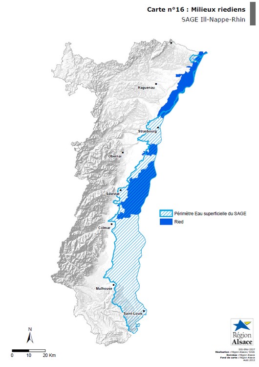
CARTE - Milieux riediens - SAGE Ill Nappe Rhin
Les milieux riediens correspondent aux rieds de l’Ill, de la Zembs et au Bruch de l’Andlau. La présence de ces zones humides s’explique par la faible profondeur de la nappe phréatique d’Alsace et l’importance du réseau hydrographique.
Simple
- Date (Publication)
- 2013-05-01
- Presentation form
- Digital map
- Point of contact
-
Organisation name Individual name Electronic mail address Role Région Alsace
Point of contact
- Theme
-
-
CARTE
-
- Theme
-
-
SAGE
-
- Denominator
- 250000
- Language
- Français
N
S
E
W
))
- Distribution format
-
Name Version PDF
1.7
- OnLine resource
-
Protocol Linkage Name WWW:DOWNLOAD-1.0-http--download
https://www.datagrandest.fr/metadata/region-grand-est/CARTES/FR-236700019-CARTE-SIG-ENV-3337-16/SIG-ENV-3337-16.pdf SIG-ENV-3337-16.pdf
OnLine resource
No information provided.
Metadata
- File identifier
- FR-236700019-CARTE-SIG-ENV-3337-16 XML
- Metadata language
- Français
- Character set
- UTF8
- Hierarchy level
- Dataset
- Date stamp
- 2013-08-02T11:10:49
- Metadata standard name
-
ISO 19115:2003/19139
- Metadata standard version
-
1.0
- Metadata author
-
Organisation name Individual name Electronic mail address Role Région Alsace
Sacha Weber
Point of contact
)))
