 Demo Catalogue powered by geOrchestra
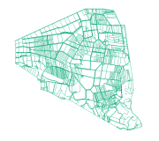
Bocage (Pleine-fougères, zone D, 1996) - Zone Atelier Armorique ZAAr
Cadre: Carte du bocage de la zone D du site de Pleine-fougères (Zone Atelier Armorique) en 1996
Programme: ECCO PNBC
Date du vol: 21/05/1996
Simple
- Date (Creation)
- 2007-01-03T00:00:00
- Citation identifier
- https://www.osuris.fr/geonetwork/srv/metadata/868f09e3-29a9-4505-b7ba-8249d7faf576
- Status
- Completed
- Point of contact
-
Organisation name Individual name Electronic mail address Role LETG-RENNES UMR 6554 CNRS Université de Rennes 2
Jean Naducet
Author
- Maintenance and update frequency
- Not planned
-
GEMET
-
-
informations géoréférencées
-
bocage
-
-
theme.thesaurus_costel.rdf
-
theme.EnvironnementFR.rdf
-
-
Sols
-
Aménagement du territoire
-
Paysages et sites
-
- Use limitation
-
Aucune condition ne s’applique
- Access constraints
- License
- Use constraints
- License
- Spatial representation type
- Vector
- Distance
- 100 m
- Language
-
fre
- Character set
- UTF8
- Topic category
-
- Imagery base maps earth cover
- Description
-
France, Fougères, site de Pleine Fougères
))
- Begin date
- 1996-05-21
- End date
- 1996-05-21
))
- Distribution format
-
Name Version ESRI Shapefile
1.0
- OnLine resource
-
Protocol Linkage Name OGC:WMS
https://www.osuris.fr/geoserver/ecobio/wms bocage96_zoneD
- Hierarchy level
- Dataset
Relative internal positional accuracy
- Evaluation method description
-
Donnée du bocage de la zone de pleine Fougères issu de la photo-interprétation de clichés aériens IGN à partir du parcelle de la ZAA non conforme IGN (digitalisation à partir du Scan 25)
Quantitative result
- Value type
- measure
- Value
- 1,5m
Conformance result
- Date (Publication)
- 2013-10-21
- Pass
- Yes
- Statement
-
Digitalisation à partir de photographies de 1996
Metadata
- File identifier
- 868f09e3-29a9-4505-b7ba-8249d7faf576 XML
- Metadata language
-
fre
- Character set
- UTF8
- Hierarchy level
- Dataset
- Hierarchy level name
-
Jeu de données
- Date stamp
- 2019-07-01T21:28:38
- Metadata standard name
-
ISO 19115
- Metadata standard version
-
1.0
- Metadata author
-
Organisation name Individual name Electronic mail address Role LETG-RENNES UMR 6554 CNRS Université de Rennes 2
Nabucet Jean
Distributor
Overviews
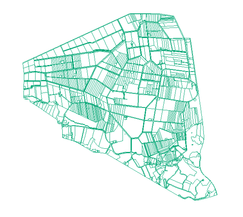
Spatial extent
Provided by
