 Demo Catalogue powered by geOrchestra
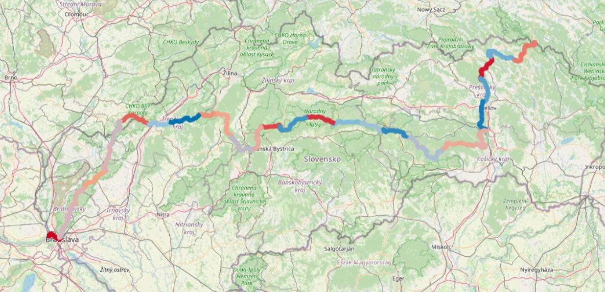
Turistická trasa Cesta hrdinov SNP
Dataset obsahuje líniovú vrstvu trasy Cesty hrdinov SNP exportovanú z platformy OpenStreetMap a editovanú rozdelením na 28 častí. Ide o úseky, ktoré poukazujú na jednotlivé etapy tejto turistickej trasy.
Vrstva obsahuje aj podrobnejšie informácie o konkrétnych etapách trasy a to: prejdenú vzdialenosť, nastúpané metre a čas prejdenia.
Podrobnejšie informácie: https://cestasnp.sk/
Simple
- Date (Publication)
- 2023-05-24
- Status
- On going
- Point of contact
-
Organisation name Individual name Electronic mail address Role Open Street Map
OSM
Point of contact
- Maintenance and update frequency
- As needed
- Keywords
-
-
cesta hrdinov SNP
-
cestovný ruch
-
turistika
-
- Keywords
-
-
turistická trasa
-
- Use limitation
-
Creative Commons Attribution 4.0 International (CC BY 4.0)
- Access constraints
- License
- Spatial representation type
- Vector
- Language
- Slovak [SK]
- Character set
- UTF8
- Topic category
-
- Location
))
- Reference system identifier
- EPSG: 5514
- Distribution format
-
Name Version SHAPEFILE
CSV
GEOJSON
- OnLine resource
-
Protocol Linkage Name OGC:WMS-1.3.0-http-get-map
https://www.geoportalksk.sk/geoserver/wms ksk_gis:cesta_hrdinov_snp
OGC:WFS
https://www.geoportalksk.sk/geoserver/wfs ksk_gis:cesta_hrdinov_snp
- Hierarchy level
- Dataset
Metadata
- File identifier
- 75ee12f1-09a5-4c59-8428-d41726f927ad XML
- Metadata language
- Slovak [SK]
- Character set
- UTF8
- Date stamp
- 2023-05-24T09:19:56
- Metadata standard name
-
ISO 19115:2003/19139
- Metadata standard version
-
1.0
- Metadata author
-
Organisation name Individual name Electronic mail address Role Košický samosprávny kraj
KSK, odbor regionálneho rozvoja, referát GIS
Point of contact
Overviews
Spatial extent
Provided by
