 Demo Catalogue powered by geOrchestra
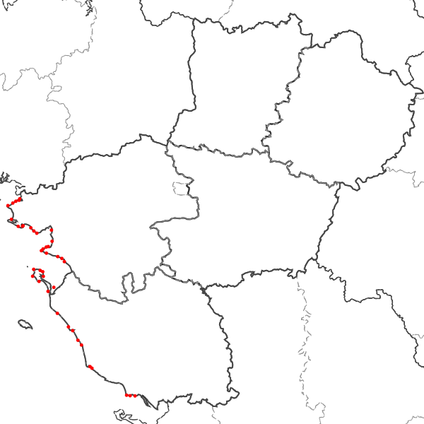
Points de contrôle de la qualité sanitaire des gisements naturels de coquillages sur les sites de pêche à pied de loisir en Pays de la Loire
Localisation des points de prélèvement pour le contrôle de la qualité sanitaire des coquillages sur les sites de pêche à pied de loisir.
Simple
- Date (Revision)
- 2024-10-15T10:23:38
- Date (Publication)
- 2013-11-12T12:02:00
- Other citation details
- r_GisementsCoq_pdl_p_r52_Specif.pdf
- Citation identifier
- https://catalogue.sigloire.fr/geonetwork/srv/6cbbc87a-4bcb-4c0f-a035-c13b1efaf8fa
- Point of contact
-
Organisation name Individual name Electronic mail address Role Agence Régionale de Santé Pays de la Loire
Point of contact
-
Régions de France
-
-
PAYS-DE-LA-LOIRE
-
-
GEMET - INSPIRE themes, version 1.0
-
-
Installations de suivi environnemental
-
- Keywords
-
- Use limitation
-
Aucune condition ne s’applique
- Access constraints
- Other restrictions
- Use constraints
- Copyright
- Other constraints
-
Pas de restriction d’accès public selon INSPIRE
Diffusion soumise à l'autorisation du service producteur
- Classification
- Unclassified
- User note
-
La ressource ne revêt pas un caractère sensible.
- Spatial representation type
- Vector
- Denominator
- 5000
- Language
-
fre
- Character set
- UTF8
- Topic category
-
- Health
- Description
-
Littoral des départements de Vendée et Loire-Atlantique
))
- Reference system identifier
- EPSG / RGF93 / Lambert-93 (EPSG:2154) / 7.4
- Distribution format
-
Name Version ZIP
- OnLine resource
-
Protocol Linkage Name OGC:WFS-1.0.0-http-get-capabilities
https://datacarto.sigloire.fr/wfs? r_gisementscoq_pdl_p_r52
- Hierarchy level
- Dataset
Conformance result
- Title
-
COMMISSION REGULATION (EU) No 1089/2010 of 23 November 2010 implementing Directive 2007/2/EC of the European Parliament and of the Council as regards interoperability of spatial data sets and services
- Date (Publication)
- 2010-11-23
- Explanation
-
-- More information on the test --
- Pass
- No
- Statement
-
Géo-localisation des points de prélèvement par GPS ou à l'aide du Scan 25. Mise à jour annuelle des données.
- Feature catalogue citation
- Feature catalogue citation
Metadata
- File identifier
- 6cbbc87a-4bcb-4c0f-a035-c13b1efaf8fa XML
- Metadata language
-
fre
- Character set
- UTF8
- Hierarchy level
- Dataset
- Date stamp
- 2024-10-15T10:25:11
- Metadata standard name
-
ISO 19115:2003/19139
- Metadata standard version
-
1.0
- Metadata author
-
Organisation name Individual name Electronic mail address Role Agence Régionale de Santé Pays de la Loire
Point of contact
)))
