 Demo Catalogue powered by geOrchestra
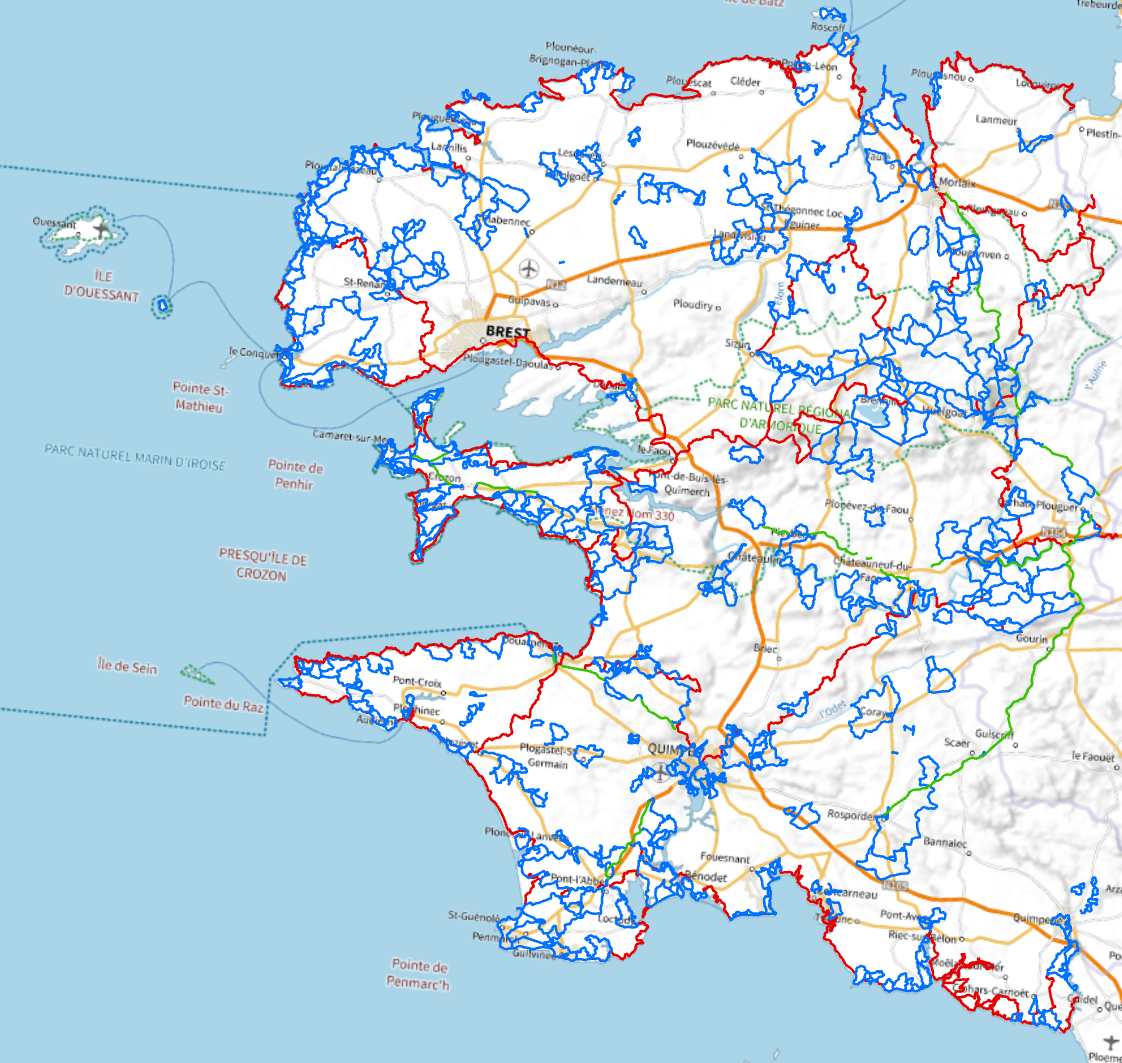
Plan départemental des itinéraires de promenade et de randonnée du Finistère (PDIPR)
Représentation des itinéraires de grande randonnée, de petite randonnée, des anciennes voies ferrées, du canal de Nantes à Brest. L'objectif étant notamment de favoriser une politique qualitative de développement de la randonnée.
Simple
- Date (Revision)
- 2024-02-02T14:00:00
- Citation identifier
- FR-222900011-RAN01
- Citation identifier
- https://geobretagne.fr/geonetwork/srv/fre/xml.metadata.get?uuid=65ca11f8-b359-4465-aa22-b88b8ec41d65
- Status
- On going
- Point of contact
-
Organisation name Individual name Electronic mail address Role Département du Finistère
DAAEE - SPNLR
Point of contact
- Maintenance and update frequency
- Weekly
- Place
-
-
Département du Finistère
-
PDIPR
-
Randonnée
-
- Theme
-
-
données ouvertes
-
sentier de randonnée
-
patrimoine naturel
-
-
GEMET - INSPIRE themes, version 1.0
-
-
Réseaux de transport
-
- Access constraints
- Other restrictions
- Other constraints
- Pas de restriction d'accès public
- Use limitation
-
Usage libre sous réserve des mentions obligatoires sur tout document de diffusion : "Source : Conseil départemental du Finistère - date"
- Use limitation
-
Licence ouverte v2.0 : https://www.etalab.gouv.fr/wp-content/uploads/2017/04/ETALAB-Licence-Ouverte-v2.0.pdf
- Use constraints
- License
- Denominator
- 25000
- Language
-
fre
- Topic category
-
- Environment
- Environment description
-
Microsoft Windows XP Version 5.1 (Build 2600) Service Pack 3; ESRI ArcCatalog 9.3.1.3000
))
- Reference system identifier
- RGF93 / Lambert-93 (EPSG:2154)
- Topology level
- Abstract
- Geometric object type
- Curve
- Geometric object count
- 233
- Distribution format
-
Name Version ESRI Shapefile
1.0
- OnLine resource
-
Protocol Linkage Name OGC:WMS
https://geobretagne.fr/geoserver/cd29/wms pdipr_29
OGC:WFS
https://geobretagne.fr/geoserver/cd29/wms?request=GetCapabilities pdipr_29
- Hierarchy level
- Dataset
- Statement
-
Numérisation des tracés à partir du cadastre PCI Vecteur.
Metadata
- File identifier
- 65ca11f8-b359-4465-aa22-b88b8ec41d65 XML
- Metadata language
-
fre
- Character set
- UTF8
- Hierarchy level
- Dataset
- Date stamp
- 2025-02-03T15:28:54.852007Z
- Metadata standard name
-
ISO 19115:2003/19139
- Metadata standard version
-
1.0
- Metadata author
-
Organisation name Individual name Electronic mail address Role Département du Finistère
SIG Fédérateur
Point of contact
)))
