 Demo Catalogue powered by geOrchestra
Atlas régional : Ouest 2. Scale of 1:1 000 000 to 1:500 000. Date of publication: 1970-1972.
1. Atlas régional Ouest 2 : café = Regional atlas : coffee. / Champaud, Jacques; Douib, A. (ill.); Scale of 1:500 000. Date of publication: 1971. (file: 02195RC_IRD_CMR_AGCU_1971_500000_IRD_CMR_AAAA_1970-72_1000000-500000.tif)
2. Atlas régional Ouest 2 : circonscriptions administratives : carte à jour au 1er avril 1971 = Regional atlas : administrative areas : map revised as at 1st April 1971. / Champaud, Jacques; Douib, A. (ill.); Scale of 1:500 000. Date of publication: 1970. (file: 02202RC_IRD_CMR_ADMI_1970_500000_IRD_CMR_AAAA_1970-72_1000000-500000.tif)
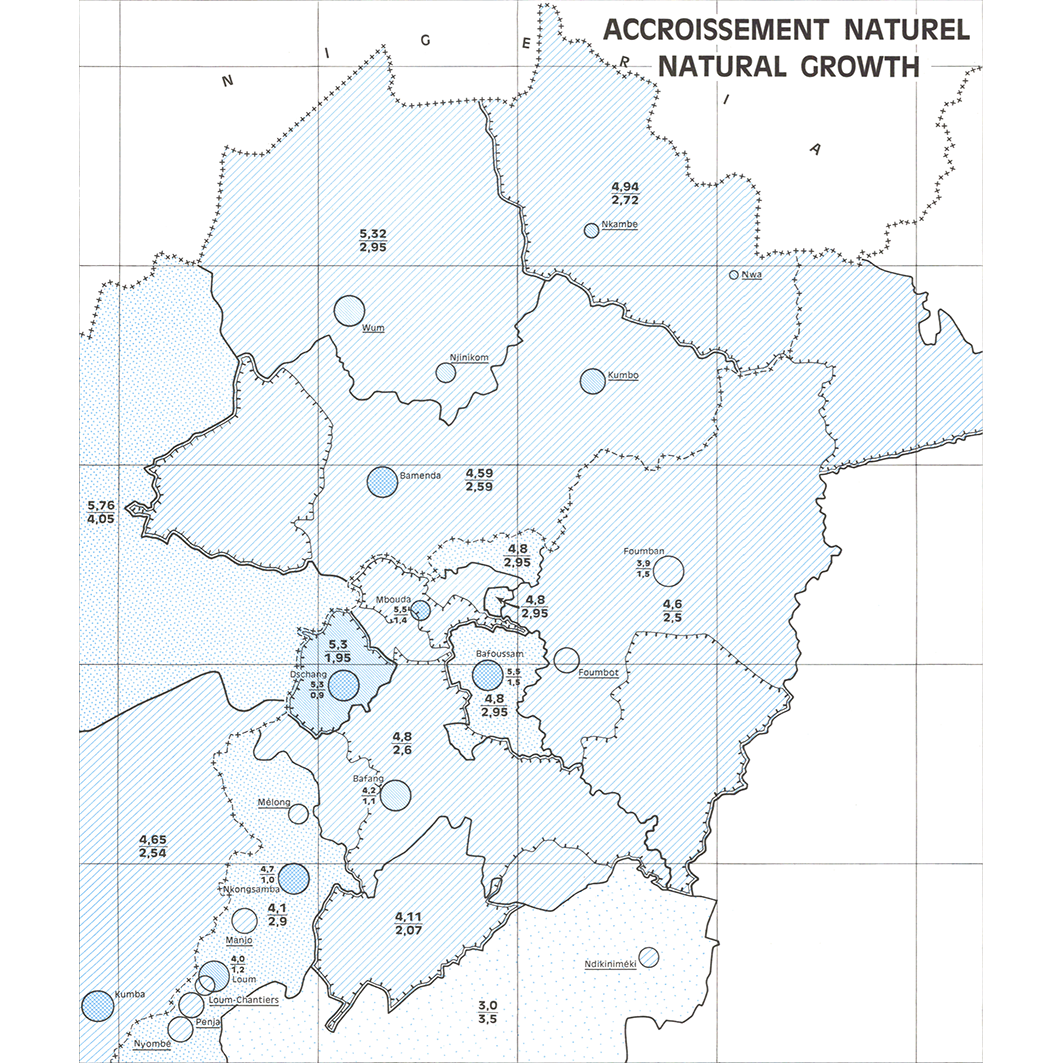
3. Atlas régional Ouest 2 : démographie = Regional atlas : demography. / Champaud, Jacques; Séguin, L. (ill.); Scale of 1:1 000 000. Date of publication: 1972. (files: 02194RC_IRD_CMR_PODM_1972_1000000-01_IRD_CMR_AAAA_1970-72_1000000-500000.tif, 02194RC_IRD_CMR_PODM_1972_1000000-02_IRD_CMR_AAAA_1970-72_1000000-500000.tif, 02194RC_IRD_CMR_PODM_1972_1000000-03_IRD_CMR_AAAA_1970-72_1000000-500000.tif, 02194RC_IRD_CMR_PODM_1972_1000000-04_IRD_CMR_AAAA_1970-72_1000000-500000.tif)
4. Atlas régional Ouest 2 : densité de population = Regional atlas : population density. / Champaud, Jacques; Douib, A. (ill.); Scale of 1:500 000. Date of publication: 1971. (file: 02196RC_IRD_CMR_PODE_1971_500000_IRD_CMR_AAAA_1970-72_1000000-500000.tif)
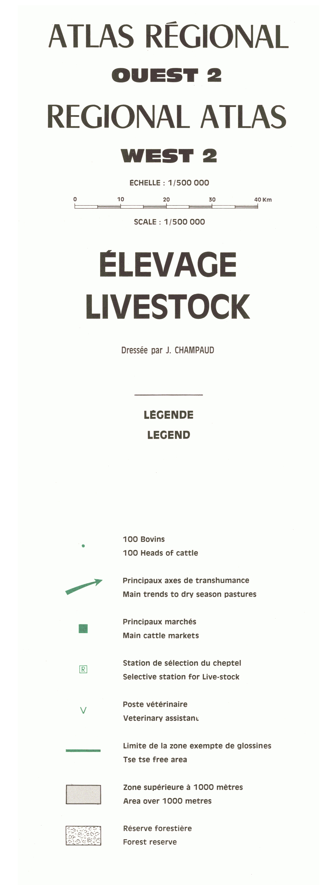
5. Atlas régional Ouest 2 : élevage = Regional atlas : livestock. / Champaud, Jacques; Douib, A. (ill.); Scale of 1:500 000. Date of publication: 1971. (file: 02199RC_IRD_CMR_AGEL_1971_500000_IRD_CMR_AAAA_1970-72_1000000-500000.tif)
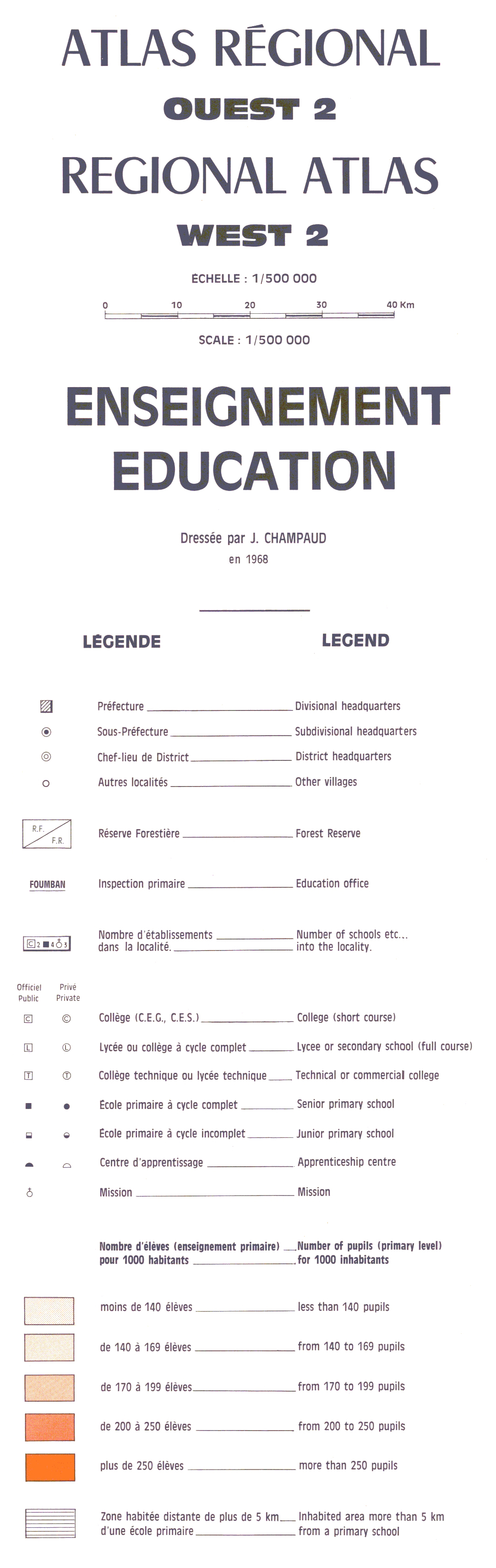
6. Atlas régional Ouest 2 : enseignement = Regional atlas : education. / Champaud, Jacques; Séguin, L. (ill.); Scale of 1:500 000. Date of publication: 1971. (file: 02200RC_IRD_CMR_POED_1971_500000_IRD_CMR_AAAA_1970-72_1000000-500000.tif)
7. Atlas régional Ouest 2 : infrastructure = Regional atlas : infrastructure. / Champaud, Jacques; Alboucq, G. (ill.); Scale of 1:500 000. Date of publication: 1970. (file: 02201RC_IRD_CMR_INFR_1970_500000_IRD_CMR_AAAA_1970-72_1000000-500000.tif)
8. Atlas régional Ouest 2 : milieu physique = Regional atlas : physical environment. / Champaud, Jacques; Douib, A. (ill.); Scale of 1:1 000 000. Date of publication: 1971. (files: 02198RC_IRD_CMR_CLPR_1971_1000000_IRD_CMR_AAAA_1970-72_1000000-500000.tif, 02198RC_IRD_CMR_GEOL_1971_1000000_IRD_CMR_AAAA_1970-72_1000000-500000.tif, 02198RC_IRD_CMR_PEDO_1971_1000000_IRD_CMR_AAAA_1970-72_1000000-500000.tif, 02198RC_IRD_CMR_TOOH_1971_1000000_IRD_CMR_AAAA_1970-72_1000000-500000.tif)
9. Atlas régional Ouest 2 : organisation de l'espace = Regional atlas : regional organisation. / Champaud, Jacques; Douib, A. (ill.); Scale of 1:500 000. Date of publication: 1971. (file: 02203RC_IRD_CMR_ESOR_1971_500000_IRD_CMR_AAAA_1970-72_1000000-500000.tif)
10. Atlas régional Ouest 2 : populations = Regional atlas : populations. / Champaud, Jacques; Alboucq, G. (ill.); Scale of 1:500 000. Date of publication: 1970. (file: 02197RC_IRD_CMR_POPU_1970_500000_IRD_CMR_AAAA_1970-72_1000000-500000.tif)
Simple
- Date (Publication)
- 1970-01-01
- Citation identifier
- IRD_CMR_AAAA_1970-72_1000000-500000
- Credit
-
The region Île-de-France, under the project NumeriSud, supported the action to transforme around 2800 maps that are conserved at the Institut de recherche pour le développement (IRD) library in Bondy into a standard coordinate system. The transformation of the images has been done by Global Mapping Resources (South Africa) under the supervision of R. Zaiss (éditeur) 2014.
- Status
- Completed
- Point of contact
-
Organisation name Individual name Electronic mail address Role Institut de recherche pour le développement (IRD)
Production cartographique IRD
Point of contact Champaud, Jacques
Author Alboucq, G. (ill.)
Author Douib, A. (ill.)
Author Séguin, L. (ill.)
Author ORSTOM, Office de la recherche scientifique et technique outre-mer, Service cartographique
editor
- Maintenance and update frequency
- Not planned
-
Geounits
-
-
Africa
-
Middle Africa
-
Cameroon
-
- Theme
-
-
map collection
-
organisation
-
orohydrographie
-
precipitation
-
topography
-
thematic map
-
- Keywords
-
-
project NumeriSud
-
local coverage
-
- Use limitation
-
Licence : CC-BY-NC-SA
- Access constraints
- licence
- Classification
- Unclassified
- Spatial representation type
- Grid
- Denominator
- 500000
- Language
- Français
- Character set
- UTF8
- Topic category
-
- Boundaries
- Climatology, meteorology, atmosphere
- Elevation
- Farming
- Geoscientific information
- Planning cadastre
- Society
))
- Begin date
- 1970-01-01
- End date
- 1972-12-31
- Supplemental Information
-
Publication(s):
Champaud, J. (1970-1972): Atlas régional : Ouest 2 : commentaires des cartes. Yaoundé (CMR) : ORSTOM, Office de la recherche scientifique et technique outre mer, Service cartographique.
- Reference system identifier
- EPSG / 4326 / 7.9
- Distribution format
-
Name Version GeoTIFF
1.0
- Distributor contact
-
Organisation name Individual name Electronic mail address Role DataSuds-geo
Publisher
- OnLine resource
-
Protocol Linkage Name OGC:WMS
https://datasuds-geo.ird.fr/geoserver/wms sphaera_ws:02195RC_IRD_CMR_AGCU_1971_500000_IRD_CMR_AAAA_1970-72_1000000-500000
WWW:DOWNLOAD:GeoTIFF https://datasuds-geo.ird.fr/geoserver/ows?service=WCS&version=2.0.1&request=GetCoverage&coverageId=02195RC_IRD_CMR_AGCU_1971_500000_IRD_CMR_AAAA_1970-72_1000000-500000 WWW:LINK-1.0-http--related
https://www.documentation.ird.fr/hor/fdi:02582 Notice explicative ou autre ouvrage
- OnLine resource
-
Protocol Linkage Name OGC:WMS
https://datasuds-geo.ird.fr/geoserver/wms sphaera_ws:02202RC_IRD_CMR_ADMI_1970_500000_IRD_CMR_AAAA_1970-72_1000000-500000
WWW:DOWNLOAD:GeoTIFF https://datasuds-geo.ird.fr/geoserver/ows?service=WCS&version=2.0.1&request=GetCoverage&coverageId=02202RC_IRD_CMR_ADMI_1970_500000_IRD_CMR_AAAA_1970-72_1000000-500000 WWW:LINK-1.0-http--related
https://www.documentation.ird.fr/hor/fdi:02582 Notice explicative ou autre ouvrage
- OnLine resource
-
Protocol Linkage Name OGC:WMS
https://datasuds-geo.ird.fr/geoserver/wms sphaera_ws:02194RC_IRD_CMR_PODM_1972_1000000-01_IRD_CMR_AAAA_1970-72_1000000-500000
WWW:DOWNLOAD:GeoTIFF https://datasuds-geo.ird.fr/geoserver/ows?service=WCS&version=2.0.1&request=GetCoverage&coverageId=02194RC_IRD_CMR_PODM_1972_1000000-01_IRD_CMR_AAAA_1970-72_1000000-500000 WWW:LINK-1.0-http--related
https://www.documentation.ird.fr/hor/fdi:02582 Notice explicative ou autre ouvrage
- OnLine resource
-
Protocol Linkage Name OGC:WMS
https://datasuds-geo.ird.fr/geoserver/wms sphaera_ws:02194RC_IRD_CMR_PODM_1972_1000000-02_IRD_CMR_AAAA_1970-72_1000000-500000
WWW:DOWNLOAD:GeoTIFF https://datasuds-geo.ird.fr/geoserver/ows?service=WCS&version=2.0.1&request=GetCoverage&coverageId=02194RC_IRD_CMR_PODM_1972_1000000-02_IRD_CMR_AAAA_1970-72_1000000-500000 WWW:LINK-1.0-http--related
https://www.documentation.ird.fr/hor/fdi:02582 Notice explicative ou autre ouvrage
- OnLine resource
-
Protocol Linkage Name OGC:WMS
https://datasuds-geo.ird.fr/geoserver/wms sphaera_ws:02194RC_IRD_CMR_PODM_1972_1000000-03_IRD_CMR_AAAA_1970-72_1000000-500000
WWW:DOWNLOAD:GeoTIFF https://datasuds-geo.ird.fr/geoserver/ows?service=WCS&version=2.0.1&request=GetCoverage&coverageId=02194RC_IRD_CMR_PODM_1972_1000000-03_IRD_CMR_AAAA_1970-72_1000000-500000 WWW:LINK-1.0-http--related
https://www.documentation.ird.fr/hor/fdi:02582 Notice explicative ou autre ouvrage
- OnLine resource
-
Protocol Linkage Name OGC:WMS
https://datasuds-geo.ird.fr/geoserver/wms sphaera_ws:02194RC_IRD_CMR_PODM_1972_1000000-04_IRD_CMR_AAAA_1970-72_1000000-500000
WWW:DOWNLOAD:GeoTIFF https://datasuds-geo.ird.fr/geoserver/ows?service=WCS&version=2.0.1&request=GetCoverage&coverageId=02194RC_IRD_CMR_PODM_1972_1000000-04_IRD_CMR_AAAA_1970-72_1000000-500000 WWW:LINK-1.0-http--related
https://www.documentation.ird.fr/hor/fdi:02582 Notice explicative ou autre ouvrage
- OnLine resource
-
Protocol Linkage Name OGC:WMS
https://datasuds-geo.ird.fr/geoserver/wms sphaera_ws:02196RC_IRD_CMR_PODE_1971_500000_IRD_CMR_AAAA_1970-72_1000000-500000
WWW:DOWNLOAD:GeoTIFF https://datasuds-geo.ird.fr/geoserver/ows?service=WCS&version=2.0.1&request=GetCoverage&coverageId=02196RC_IRD_CMR_PODE_1971_500000_IRD_CMR_AAAA_1970-72_1000000-500000 WWW:LINK-1.0-http--related
https://www.documentation.ird.fr/hor/fdi:02582 Notice explicative ou autre ouvrage
- OnLine resource
-
Protocol Linkage Name OGC:WMS
https://datasuds-geo.ird.fr/geoserver/wms sphaera_ws:02199RC_IRD_CMR_AGEL_1971_500000_IRD_CMR_AAAA_1970-72_1000000-500000
WWW:DOWNLOAD:GeoTIFF https://datasuds-geo.ird.fr/geoserver/ows?service=WCS&version=2.0.1&request=GetCoverage&coverageId=02199RC_IRD_CMR_AGEL_1971_500000_IRD_CMR_AAAA_1970-72_1000000-500000 WWW:LINK-1.0-http--related
https://www.documentation.ird.fr/hor/fdi:02582 Notice explicative ou autre ouvrage
- OnLine resource
-
Protocol Linkage Name OGC:WMS
https://datasuds-geo.ird.fr/geoserver/wms sphaera_ws:02200RC_IRD_CMR_POED_1971_500000_IRD_CMR_AAAA_1970-72_1000000-500000
WWW:DOWNLOAD:GeoTIFF https://datasuds-geo.ird.fr/geoserver/ows?service=WCS&version=2.0.1&request=GetCoverage&coverageId=02200RC_IRD_CMR_POED_1971_500000_IRD_CMR_AAAA_1970-72_1000000-500000 WWW:LINK-1.0-http--related
https://www.documentation.ird.fr/hor/fdi:02582 Notice explicative ou autre ouvrage
- OnLine resource
-
Protocol Linkage Name OGC:WMS
https://datasuds-geo.ird.fr/geoserver/wms sphaera_ws:02201RC_IRD_CMR_INFR_1970_500000_IRD_CMR_AAAA_1970-72_1000000-500000
WWW:DOWNLOAD:GeoTIFF https://datasuds-geo.ird.fr/geoserver/ows?service=WCS&version=2.0.1&request=GetCoverage&coverageId=02201RC_IRD_CMR_INFR_1970_500000_IRD_CMR_AAAA_1970-72_1000000-500000 WWW:LINK-1.0-http--related
https://www.documentation.ird.fr/hor/fdi:02582 Notice explicative ou autre ouvrage
- OnLine resource
-
Protocol Linkage Name OGC:WMS
https://datasuds-geo.ird.fr/geoserver/wms sphaera_ws:02198RC_IRD_CMR_CLPR_1971_1000000_IRD_CMR_AAAA_1970-72_1000000-500000
WWW:DOWNLOAD:GeoTIFF https://datasuds-geo.ird.fr/geoserver/ows?service=WCS&version=2.0.1&request=GetCoverage&coverageId=02198RC_IRD_CMR_CLPR_1971_1000000_IRD_CMR_AAAA_1970-72_1000000-500000 WWW:LINK-1.0-http--related
https://www.documentation.ird.fr/hor/fdi:02582 Notice explicative ou autre ouvrage
- OnLine resource
-
Protocol Linkage Name OGC:WMS
https://datasuds-geo.ird.fr/geoserver/wms sphaera_ws:02198RC_IRD_CMR_GEOL_1971_1000000_IRD_CMR_AAAA_1970-72_1000000-500000
WWW:DOWNLOAD:GeoTIFF https://datasuds-geo.ird.fr/geoserver/ows?service=WCS&version=2.0.1&request=GetCoverage&coverageId=02198RC_IRD_CMR_GEOL_1971_1000000_IRD_CMR_AAAA_1970-72_1000000-500000 WWW:LINK-1.0-http--related
https://www.documentation.ird.fr/hor/fdi:02582 Notice explicative ou autre ouvrage
- OnLine resource
-
Protocol Linkage Name OGC:WMS
https://datasuds-geo.ird.fr/geoserver/wms sphaera_ws:02198RC_IRD_CMR_PEDO_1971_1000000_IRD_CMR_AAAA_1970-72_1000000-500000
WWW:DOWNLOAD:GeoTIFF https://datasuds-geo.ird.fr/geoserver/ows?service=WCS&version=2.0.1&request=GetCoverage&coverageId=02198RC_IRD_CMR_PEDO_1971_1000000_IRD_CMR_AAAA_1970-72_1000000-500000 WWW:LINK-1.0-http--related
https://www.documentation.ird.fr/hor/fdi:02582 Notice explicative ou autre ouvrage
- OnLine resource
-
Protocol Linkage Name OGC:WMS
https://datasuds-geo.ird.fr/geoserver/wms sphaera_ws:02198RC_IRD_CMR_TOOH_1971_1000000_IRD_CMR_AAAA_1970-72_1000000-500000
WWW:DOWNLOAD:GeoTIFF https://datasuds-geo.ird.fr/geoserver/ows?service=WCS&version=2.0.1&request=GetCoverage&coverageId=02198RC_IRD_CMR_TOOH_1971_1000000_IRD_CMR_AAAA_1970-72_1000000-500000 WWW:LINK-1.0-http--related
https://www.documentation.ird.fr/hor/fdi:02582 Notice explicative ou autre ouvrage
- OnLine resource
-
Protocol Linkage Name OGC:WMS
https://datasuds-geo.ird.fr/geoserver/wms sphaera_ws:02203RC_IRD_CMR_ESOR_1971_500000_IRD_CMR_AAAA_1970-72_1000000-500000
WWW:DOWNLOAD:GeoTIFF https://datasuds-geo.ird.fr/geoserver/ows?service=WCS&version=2.0.1&request=GetCoverage&coverageId=02203RC_IRD_CMR_ESOR_1971_500000_IRD_CMR_AAAA_1970-72_1000000-500000 WWW:LINK-1.0-http--related
https://www.documentation.ird.fr/hor/fdi:02582 Notice explicative ou autre ouvrage
- OnLine resource
-
Protocol Linkage Name OGC:WMS
https://datasuds-geo.ird.fr/geoserver/wms sphaera_ws:02197RC_IRD_CMR_POPU_1970_500000_IRD_CMR_AAAA_1970-72_1000000-500000
WWW:DOWNLOAD:GeoTIFF https://datasuds-geo.ird.fr/geoserver/ows?service=WCS&version=2.0.1&request=GetCoverage&coverageId=02197RC_IRD_CMR_POPU_1970_500000_IRD_CMR_AAAA_1970-72_1000000-500000 WWW:LINK-1.0-http--related
https://www.documentation.ird.fr/hor/fdi:02582 Notice explicative ou autre ouvrage
- OnLine resource
-
Protocol Linkage Name DOI
https://doi.org/10.23708/4cd90707-558e-48aa-a82e-c7a4990da687 Digital Object Identifier (DOI)
- Hierarchy level
- Dataset
- Statement
-
1. Scanning to tif format, 256 colors, 250dpi.
2. Georeferencing and if possible reprojection to WGS84 (Longitude / Latitude).
3. Clipping and mosaicing of map sheets(s).
4. Export ECW format.
5. ECW to GeoTIFF format conversion.
Metadata
- File identifier
- 4cd90707-558e-48aa-a82e-c7a4990da687 XML
- Metadata language
- English
- Character set
- UTF8
- Hierarchy level
- Dataset
- Hierarchy level name
-
dataset
- Date stamp
- 2024-02-13T18:36:03.02373Z
- Metadata standard name
-
ISO 19115:2003/19139
- Metadata standard version
-
1.0
- Metadata author
-
Organisation name Individual name Electronic mail address Role Institut de recherche pour le développement (IRD)
Service de l'Information Scientifique et Technique (IST) IRD
Point of contact Institut de recherche pour le développement (IRD)
IRD
Resource provider
Overviews


Spatial extent
Provided by
