 Demo Catalogue powered by geOrchestra
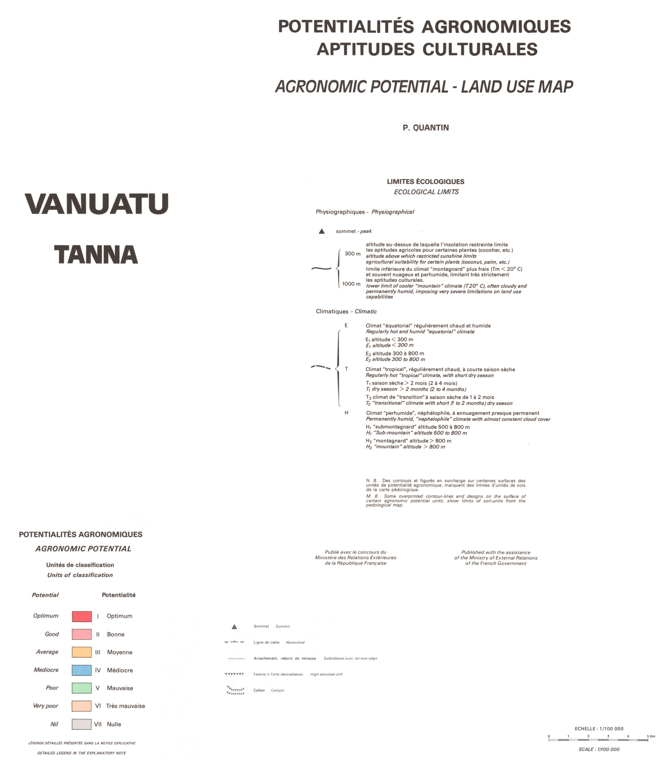
Vanuatu : potentialités agronomiques, aptitudes culturales. Scale of 1:100 000 to 1:50 000. Date of publication: 1982.
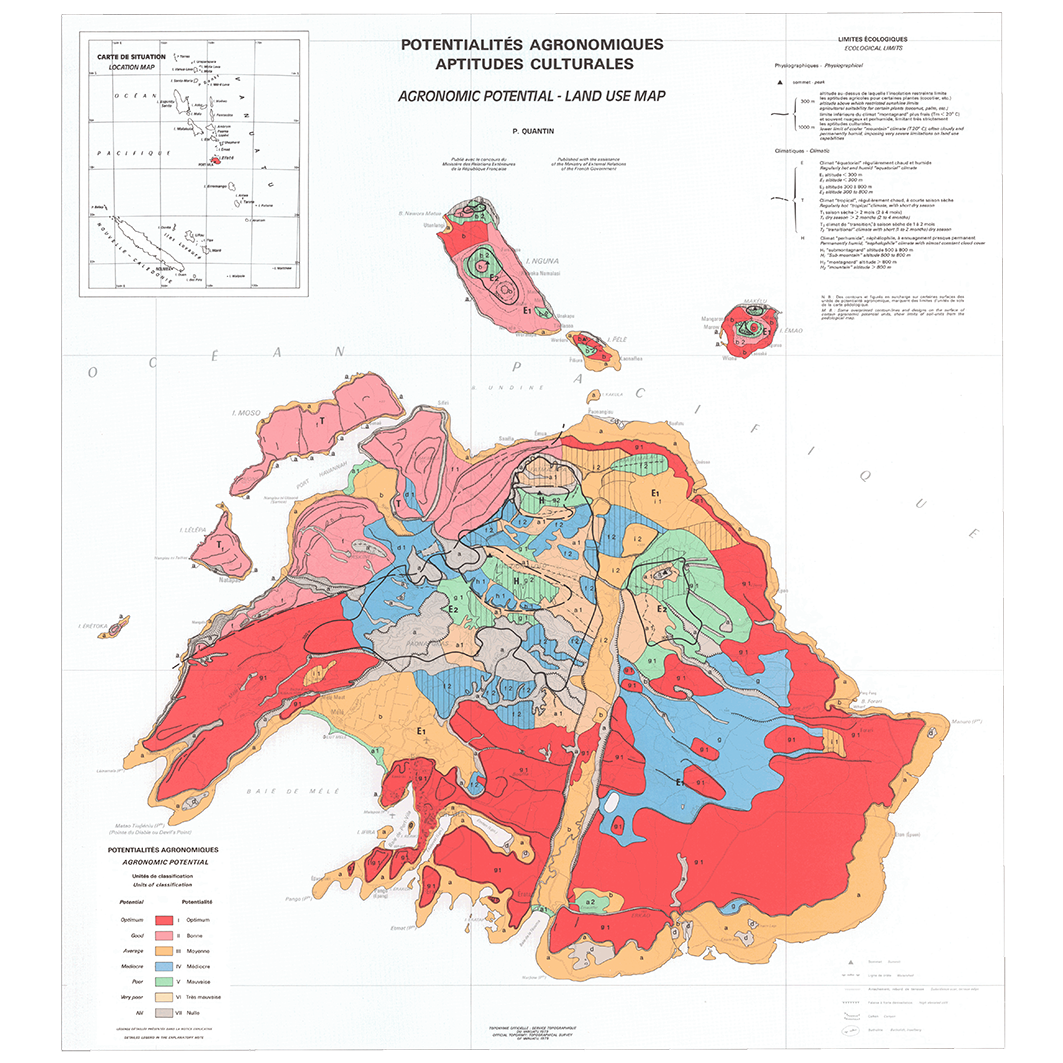
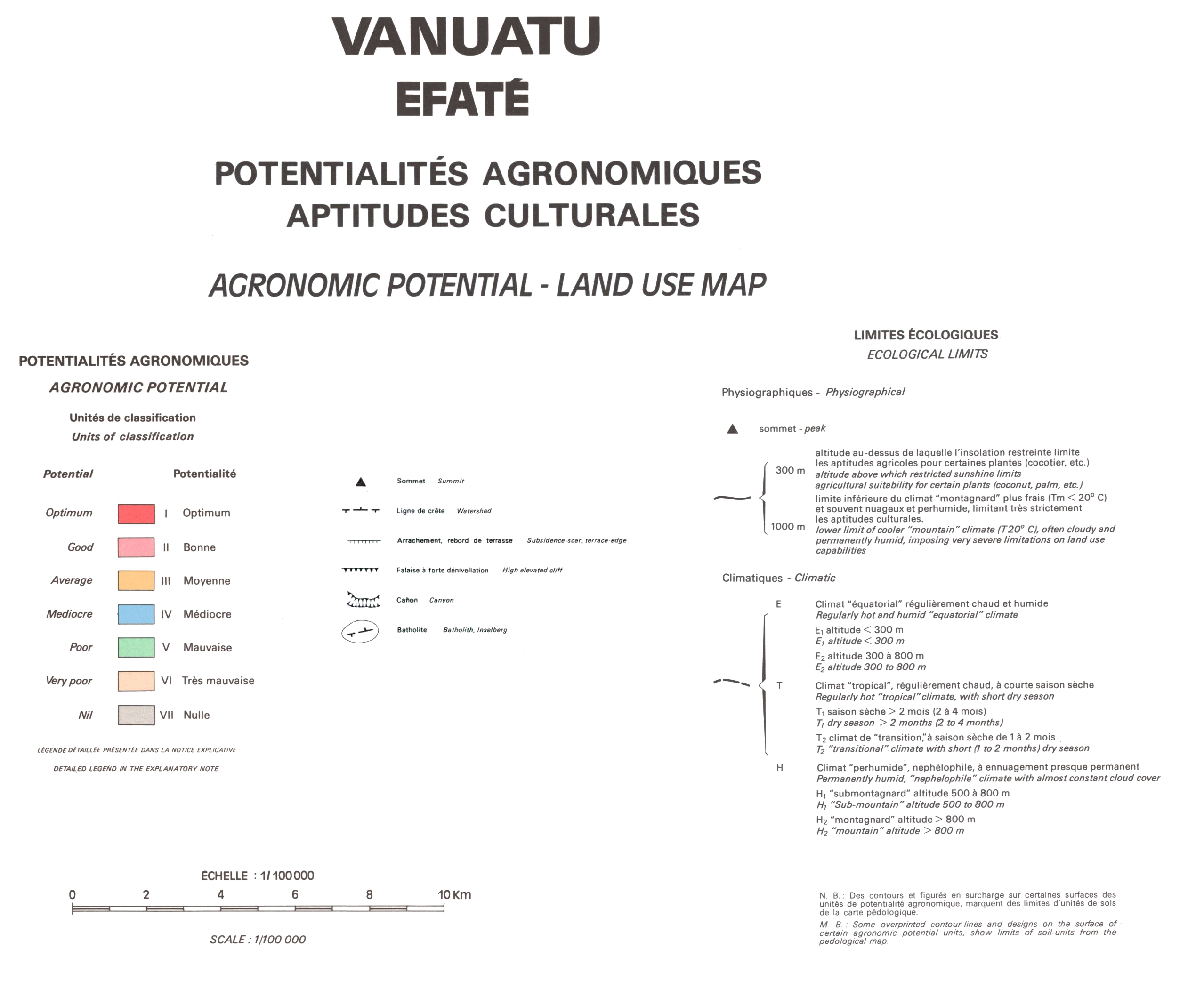
1. Vanuatu : Efaté : potentialités agronomiques, aptitudes culturales = Vanuatu : Efaté : agronomic potential, land use map. / Quantin, P.; Scale of 1:100 000. Date of publication: 1982. (file: 02391RC_IRD_VUT_AGRO_1982_100000_IRD_VUT_AGRO_1982_100000-50000.tif)
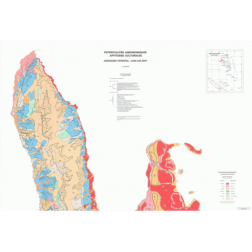
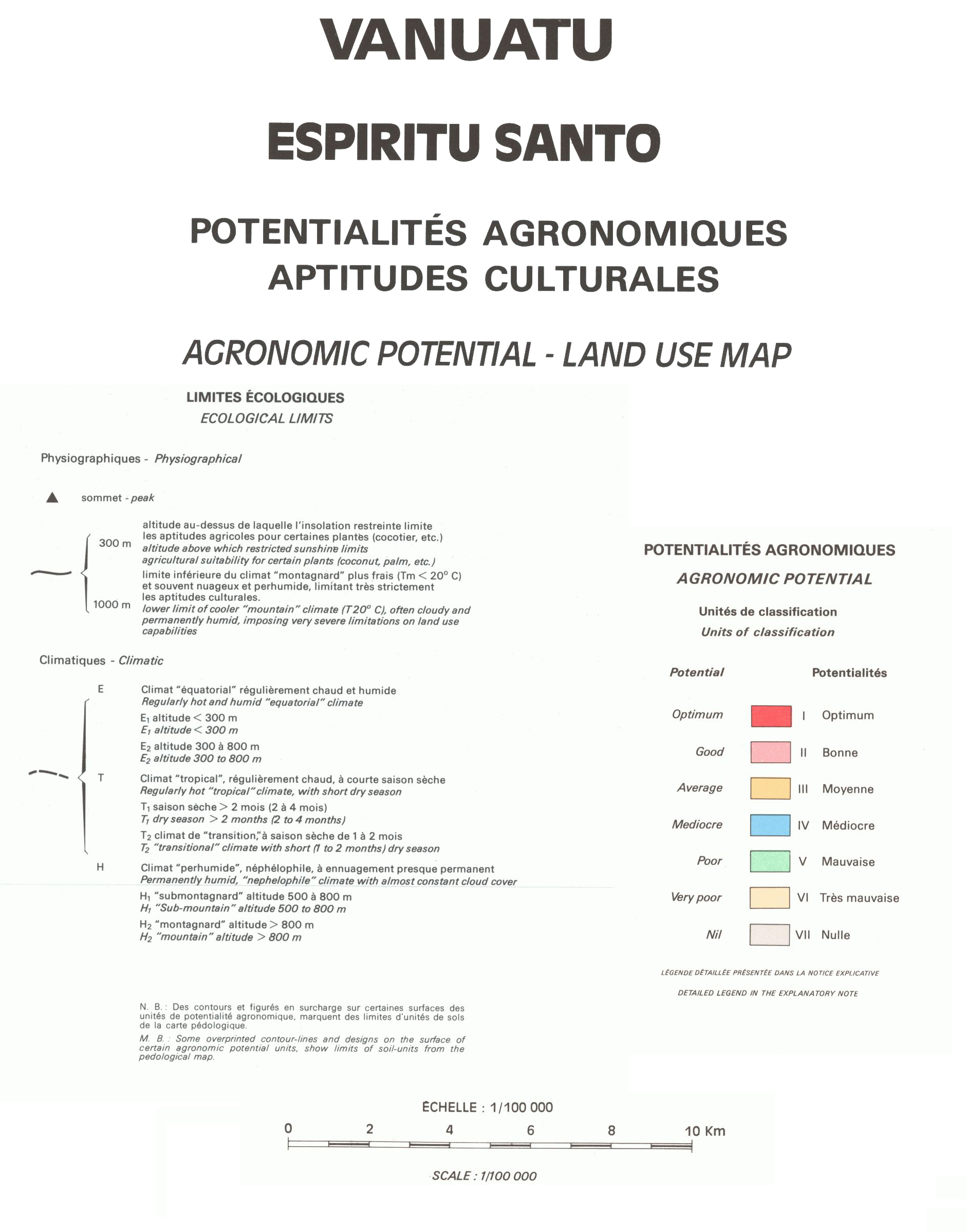
2. Vanuatu : Espiritu Santo : potentialités agronomiques, aptitudes culturales : feuille nord = Vanuatu : Espiritu Santo : agronomic potential, land use map. / Quantin, P.; Scale of 1:100 000. Date of publication: 1982. (file: 02393RC_IRD_VUT_AGRO_1982_100000_IRD_VUT_AGRO_1982_100000-50000.tif)
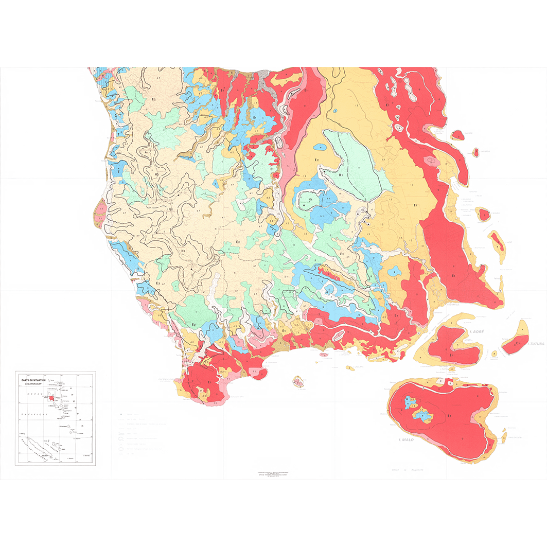
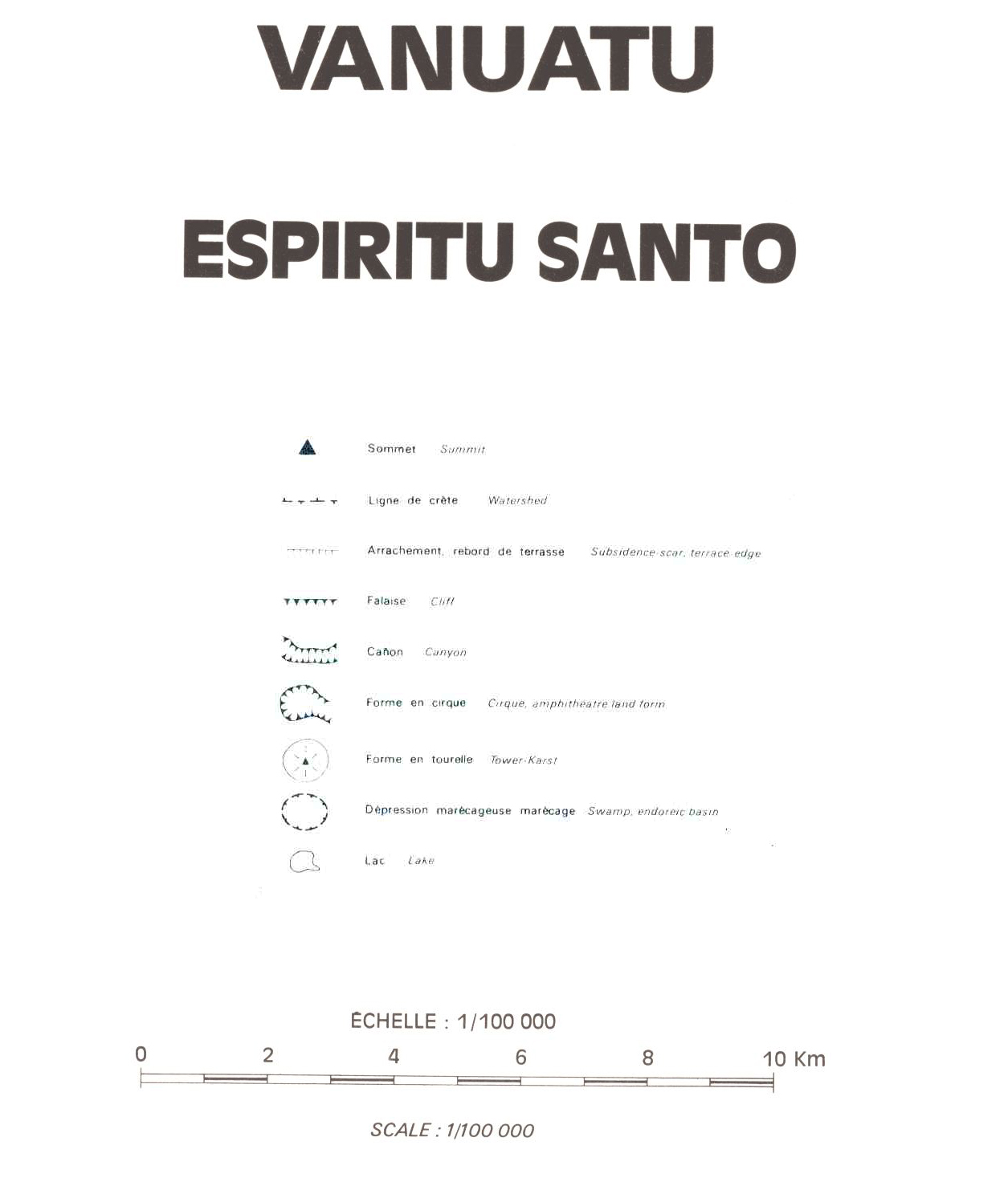
3. Vanuatu : Espiritu Santo : potentialités agronomiques, aptitudes culturales : feuille sud = Vanuatu : Espiritu Santo : agronomic potential, land use map. / Quantin, P.; Scale of 1:100 000. Date of publication: 1982. (file: 02394RC_IRD_VUT_AGRO_1982_100000_IRD_VUT_AGRO_1982_100000-50000.tif)
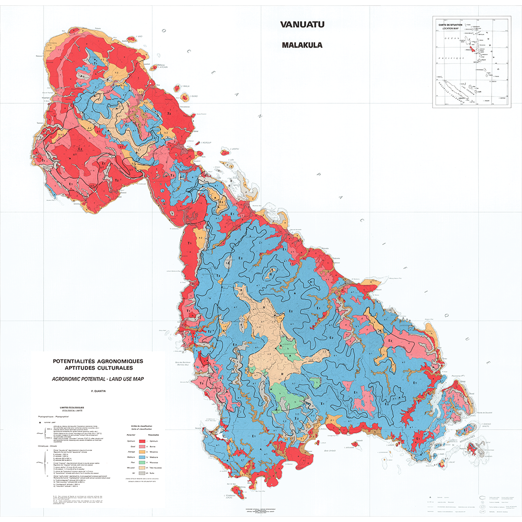
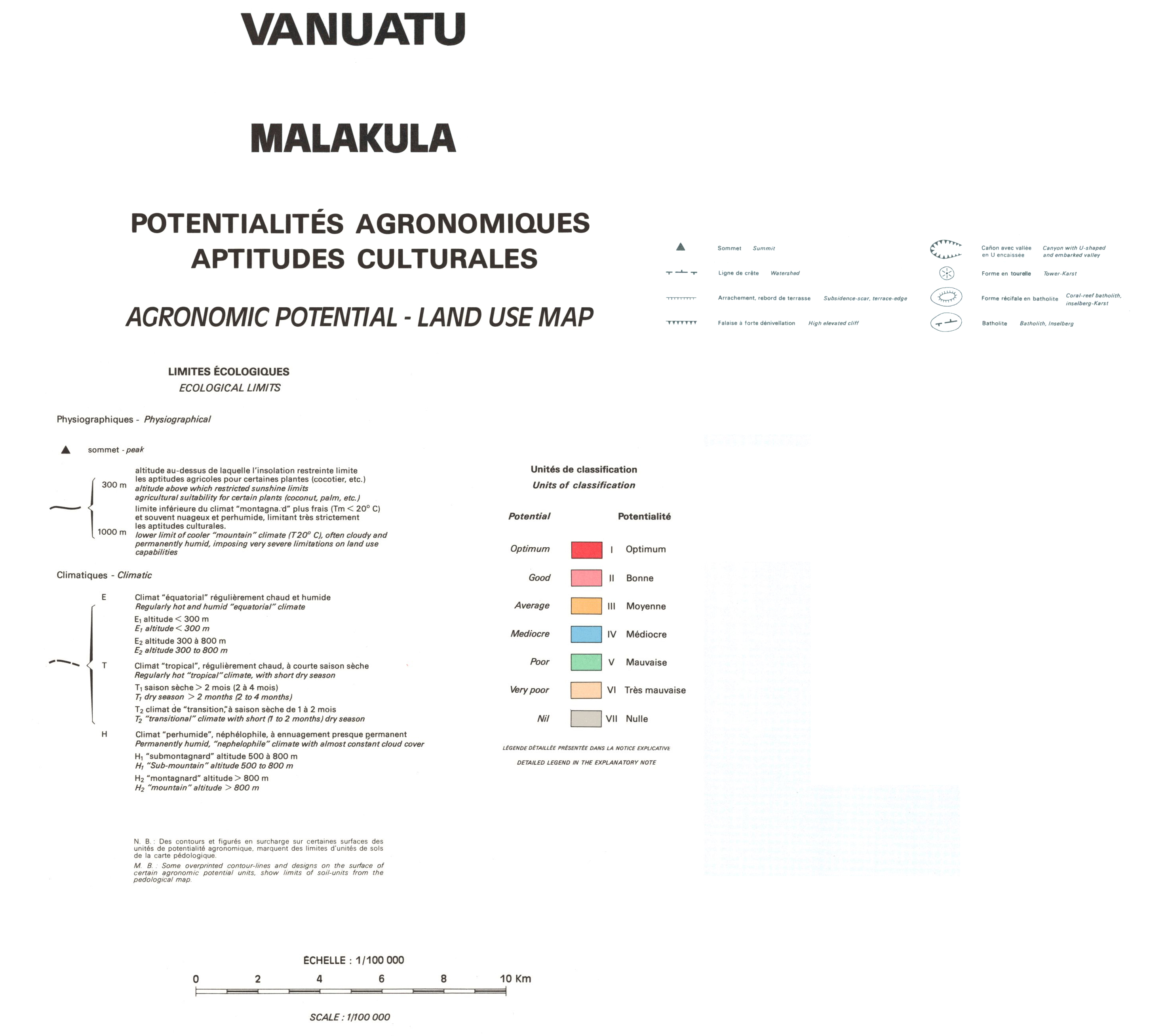
4. Vanuatu : Malakula : potentialités agronomiques, aptitudes culturales = Vanuatu : Malakula : agronomic potential, land use map. / Quantin, P.; Scale of 1:100 000. Date of publication: 1982. (file: 02390RC_IRD_VUT_AGRO_1982_100000_IRD_VUT_AGRO_1982_100000-50000.tif)
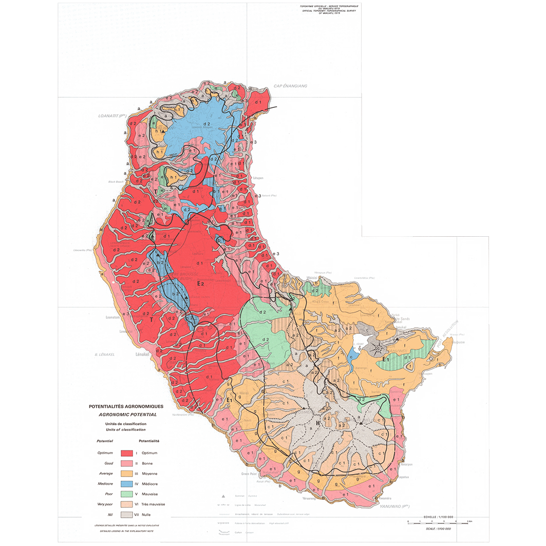
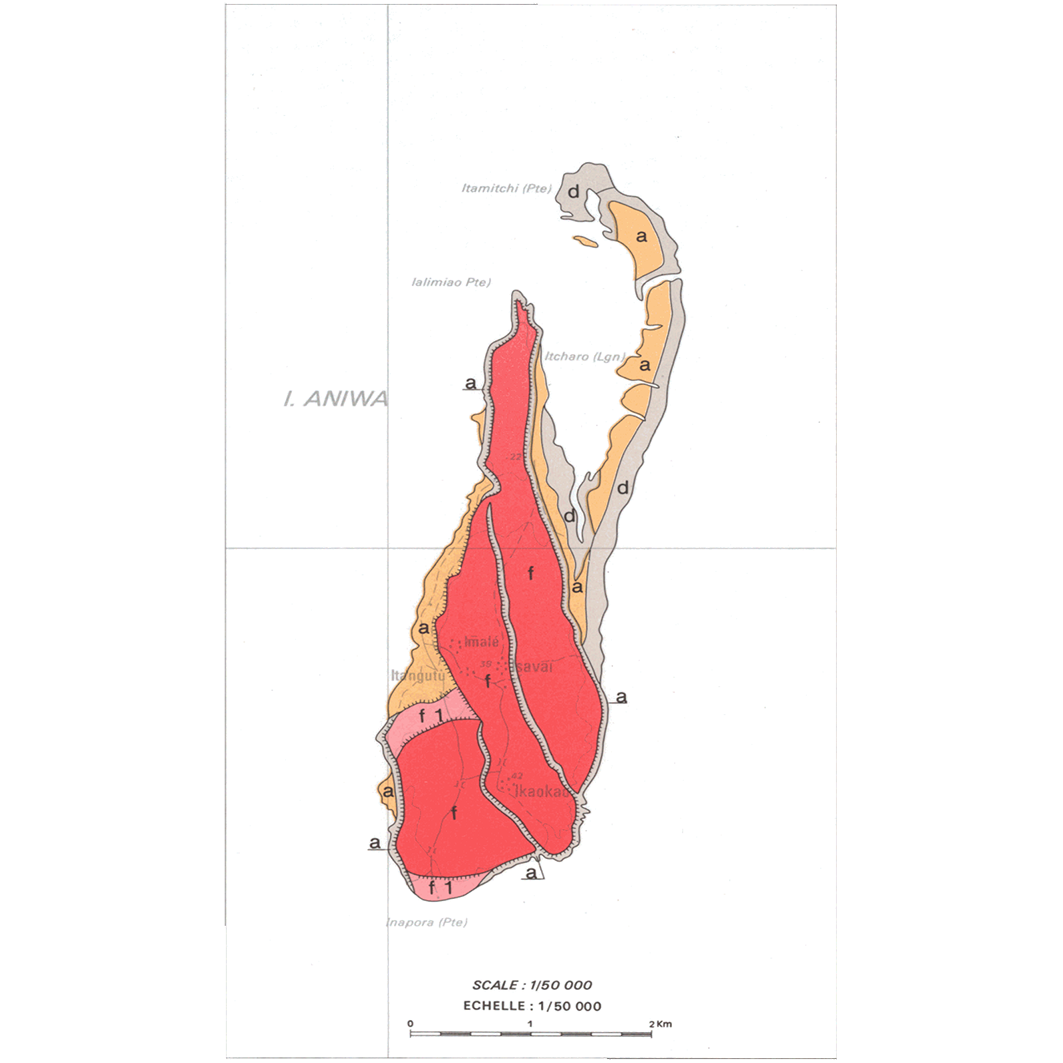
5. Vanuatu : Tanna : potentialités agronomiques, aptitudes culturales = Vanuatu : Tanna : agronomic potential, land use map. / Quantin, P.; Scale of 1:100 000 to 1:50 000. Date of publication: 1982. (files: 02392RC_IRD_VUT_AGRO_1982_100000_IRD_VUT_AGRO_1982_100000-50000.tif, 02392RC_IRD_VUT_AGRO_1982_50000_IRD_VUT_AGRO_1982_100000-50000.tif)
Simple
- Date (Publication)
- 1982-01-01
- Citation identifier
- IRD_VUT_AGRO_1982_100000-50000
- Credit
-
The region Île-de-France, under the project NumeriSud, supported the action to transforme around 2800 maps that are conserved at the Institut de recherche pour le développement (IRD) library in Bondy into a standard coordinate system. The transformation of the images has been done by Global Mapping Resources (South Africa) under the supervision of R. Zaiss (éditeur) 2014.
- Status
- Completed
- Point of contact
-
Organisation name Individual name Electronic mail address Role Institut de recherche pour le développement (IRD)
Production cartographique IRD
Point of contact Quantin, P.
Author Ministère des affaires foncières et des ressources naturelles
editor ORSTOM, Office de la recherche scientifique et technique outre-mer, Service cartographique
editor
- Maintenance and update frequency
- Not planned
-
Geounits
-
-
Oceania
-
Melanesia
-
Vanuatu
-
- Theme
-
-
thematic map
-
- Keywords
-
-
project NumeriSud
-
national coverage
-
local coverage
-
- Use limitation
-
Licence : CC-BY-NC-SA
- Access constraints
- licence
- Classification
- Unclassified
- Spatial representation type
- Grid
- Denominator
- 50000
- Language
- Français
- Character set
- UTF8
- Topic category
-
- Farming
- Planning cadastre
))
))
))
))
))
- Begin date
- 1982-01-01
- End date
- 1982-12-31
- Supplemental Information
-
Publication(s):
Quantin, P. (1982): Vanuatu : carte des potentialités agronomiques et des aptitudes culturales : notice explicative = Vanuatu : agronomic potential and land use map : explanatory notes. Paris (FRA) : ORSTOM, Office de la recherche scientifique et technique outre mer, Service cartographique ; Port Vila (VUT) : Ministère des affaires foncières et des ressources naturelles.
- Reference system identifier
- EPSG / 4326 / 7.9
- Distribution format
-
Name Version GeoTIFF
1.0
- Distributor contact
-
Organisation name Individual name Electronic mail address Role DataSuds-geo
Publisher
- OnLine resource
-
Protocol Linkage Name OGC:WMS
https://datasuds-geo.ird.fr/geoserver/wms sphaera_ws:02391RC_IRD_VUT_AGRO_1982_100000_IRD_VUT_AGRO_1982_100000-50000
WWW:DOWNLOAD:GeoTIFF https://datasuds-geo.ird.fr/geoserver/ows?service=WCS&version=2.0.1&request=GetCoverage&coverageId=02391RC_IRD_VUT_AGRO_1982_100000_IRD_VUT_AGRO_1982_100000-50000 WWW:LINK-1.0-http--related
https://www.documentation.ird.fr/hor/fdi:02985 Notice explicative ou autre ouvrage
- OnLine resource
-
Protocol Linkage Name OGC:WMS
https://datasuds-geo.ird.fr/geoserver/wms sphaera_ws:02393RC_IRD_VUT_AGRO_1982_100000_IRD_VUT_AGRO_1982_100000-50000
WWW:DOWNLOAD:GeoTIFF https://datasuds-geo.ird.fr/geoserver/ows?service=WCS&version=2.0.1&request=GetCoverage&coverageId=02393RC_IRD_VUT_AGRO_1982_100000_IRD_VUT_AGRO_1982_100000-50000 WWW:LINK-1.0-http--related
https://www.documentation.ird.fr/hor/fdi:02985 Notice explicative ou autre ouvrage
- OnLine resource
-
Protocol Linkage Name OGC:WMS
https://datasuds-geo.ird.fr/geoserver/wms sphaera_ws:02394RC_IRD_VUT_AGRO_1982_100000_IRD_VUT_AGRO_1982_100000-50000
WWW:DOWNLOAD:GeoTIFF https://datasuds-geo.ird.fr/geoserver/ows?service=WCS&version=2.0.1&request=GetCoverage&coverageId=02394RC_IRD_VUT_AGRO_1982_100000_IRD_VUT_AGRO_1982_100000-50000 WWW:LINK-1.0-http--related
https://www.documentation.ird.fr/hor/fdi:02985 Notice explicative ou autre ouvrage
- OnLine resource
-
Protocol Linkage Name OGC:WMS
https://datasuds-geo.ird.fr/geoserver/wms sphaera_ws:02390RC_IRD_VUT_AGRO_1982_100000_IRD_VUT_AGRO_1982_100000-50000
WWW:DOWNLOAD:GeoTIFF https://datasuds-geo.ird.fr/geoserver/ows?service=WCS&version=2.0.1&request=GetCoverage&coverageId=02390RC_IRD_VUT_AGRO_1982_100000_IRD_VUT_AGRO_1982_100000-50000 WWW:LINK-1.0-http--related
https://www.documentation.ird.fr/hor/fdi:02985 Notice explicative ou autre ouvrage
- OnLine resource
-
Protocol Linkage Name OGC:WMS
https://datasuds-geo.ird.fr/geoserver/wms sphaera_ws:02392RC_IRD_VUT_AGRO_1982_100000_IRD_VUT_AGRO_1982_100000-50000
WWW:DOWNLOAD:GeoTIFF https://datasuds-geo.ird.fr/geoserver/ows?service=WCS&version=2.0.1&request=GetCoverage&coverageId=02392RC_IRD_VUT_AGRO_1982_100000_IRD_VUT_AGRO_1982_100000-50000 WWW:LINK-1.0-http--related
https://www.documentation.ird.fr/hor/fdi:02985 Notice explicative ou autre ouvrage
- OnLine resource
-
Protocol Linkage Name OGC:WMS
https://datasuds-geo.ird.fr/geoserver/wms sphaera_ws:02392RC_IRD_VUT_AGRO_1982_50000_IRD_VUT_AGRO_1982_100000-50000
WWW:DOWNLOAD:GeoTIFF https://datasuds-geo.ird.fr/geoserver/ows?service=WCS&version=2.0.1&request=GetCoverage&coverageId=02392RC_IRD_VUT_AGRO_1982_50000_IRD_VUT_AGRO_1982_100000-50000 WWW:LINK-1.0-http--related
https://www.documentation.ird.fr/hor/fdi:02985 Notice explicative ou autre ouvrage
- OnLine resource
-
Protocol Linkage Name DOI
https://doi.org/10.23708/25f8b395-ef62-4e0c-880a-73ee5ed322c1 Digital Object Identifier (DOI)
- Hierarchy level
- Dataset
- Statement
-
1. Scanning to tif format, 256 colors, 250dpi.
2. Georeferencing and if possible reprojection to WGS84 (Longitude / Latitude).
3. Clipping and mosaicing of map sheets(s).
4. Export ECW format.
5. ECW to GeoTIFF format conversion.
Metadata
- File identifier
- 25f8b395-ef62-4e0c-880a-73ee5ed322c1 XML
- Metadata language
- English
- Character set
- UTF8
- Hierarchy level
- Dataset
- Hierarchy level name
-
dataset
- Date stamp
- 2024-02-13T16:57:00.74524Z
- Metadata standard name
-
ISO 19115:2003/19139
- Metadata standard version
-
1.0
- Metadata author
-
Organisation name Individual name Electronic mail address Role Institut de recherche pour le développement (IRD)
Service de l'Information Scientifique et Technique (IST) IRD
Point of contact Institut de recherche pour le développement (IRD)
IRD
Resource provider
Overviews

Spatial extent
Provided by
