 Demo Catalogue powered by geOrchestra
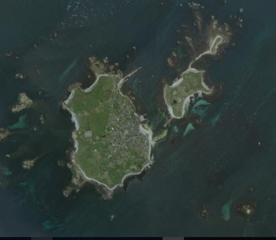
Orthophotographie du Finistère 2018
Orthophotographie réalisée sur le territoire du Finistère en 2018 dans le cadre d'un marché Mégalis Bretagne et suivi techniquement par le pôle métier ortho29 de GéoBretagne.
Caractéristiques techniques :
Résolution : 20 cm
Précision : 40 cm
La prise de vue a été réalisée en été 2018.
Simple
- Alternate title
-
ortho-29-2018
- Date (Publication)
- 2020-04-27T00:00:00
- Edition
-
2018
- Citation identifier
- FR-233500016-ortho-29-2018
- Purpose
-
La volonté des collectivités territoriales dans le Finistère et plus généralement en Bretagne répond à deux objectifs précis :
- améliorer la précision des données disponibles,
- disposer d'une orthophotographie libre de droits
- Status
- Completed
- Point of contact
-
Organisation name Individual name Electronic mail address Role Région Bretagne
Service Connaissance, Observation, Planification et Prospective
Point of contact Département du Finistère
Resource provider
- Maintenance and update frequency
- As needed
- Maintenance note
-
La mise à jour est prévue tous les 3 ans
- Place
-
-
Finistère
-
- Theme
-
-
ortho
-
données ouvertes
-
-
GEMET - INSPIRE themes, version 1.0
-
-
Ortho-imagerie
-
-
external
-
-
image satellite
-
-
external
-
-
photographie aérienne
-
-
GéoBretagne v 2.0
-
-
référentiels : imagerie
-
- Access constraints
- Other restrictions
- Other constraints
- Pas de restriction d'accès public
- Use limitation
-
Usage libre sous réserve des mentions obligatoires sur tout document de diffusion : "Source : Mégalis Bretagne et collectivités territoriales bretonnes - 2015"
- Use limitation
-
Licence ouverte : https://www.etalab.gouv.fr/licence-ouverte-open-licence
- Use constraints
- License
- Spatial representation type
- Grid
- Distance
- 0.2 m
- Language
-
fre
- Topic category
-
- Imagery base maps earth cover
- Description
-
Finistère
))
- Reference system identifier
- RGF93 / Lambert-93 / EPSG:2154
Distributor
- Distributor contact
-
Organisation name Individual name Electronic mail address Role Mégalis Bretagne
Distributor
- Distributor format
-
Name Version GeoTIFF
1.0
- OnLine resource
-
Protocol Linkage Name OGC:WMS
https://geobretagne.fr/geoserver/photo/wms ortho-29-2018
OGC:WCS
https://geobretagne.fr/geoserver/photo/wcs?SERVICE=WCS&REQUEST=GetCapabilities ortho-29-2018
WWW:DOWNLOAD-1.0-http--download
https://geoservices.ign.fr/bdortho Téléchargement IGN (format JP2000)
- Hierarchy level
- Dataset
Conformance result
- Title
-
INSPIRE Data Specification for the spatial data theme Orthoimagery
- Date (Publication)
- 2013-12-10
- Explanation
-
Non Evalué
- Pass
- No
- Statement
-
La prise de vue a été réalisée en été 2018.
C'est la société GéoFIT qui a réalisé l'orthophotographie.
Metadata
- File identifier
- 255ebc48-e56c-482b-bf15-1579aa2fe729 XML
- Metadata language
-
fre
- Character set
- UTF8
- Hierarchy level
- Dataset
- Date stamp
- 2025-02-03T15:28:22.0017Z
- Metadata standard name
-
ISO 19115
- Metadata standard version
-
1.0
- Metadata author
-
Organisation name Individual name Electronic mail address Role Région Bretagne
Service Connaissance, Observation, Planification et Prospective
Point of contact
)))
