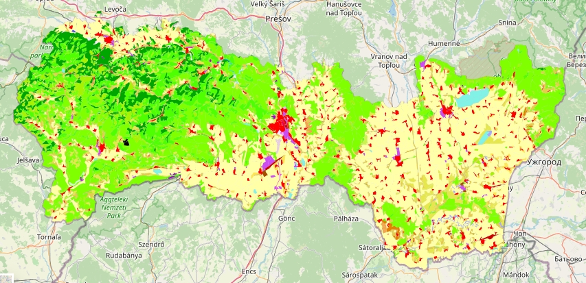
Krajinná pokrývka na území Košického samosprávneho kraja (2018)
Krajinná pokrývka (CORINE Land Cover) predstavuje fyzický stav krajiny, ktorý predstavujú prírodné, ako aj človekom pozmenené a vytvorené objekty.
Bližšie informácie o zdroji dát: https://land.copernicus.eu/
Simple
- Date (Publication)
- 2022-10-10
- Status
- On going
- Point of contact
-
Organisation name Individual name Electronic mail address Role Košický samosprávny kraj
KSK, odbor regionálneho rozvoja, referát GIS
Point of contact
- Maintenance and update frequency
- As needed
- Keywords
-
-
využitie zeme
-
CORINE Land Cover
-
- Keywords
-
-
GEMET - INSPIRE themes, version 1.0
-
-
Krajinná pokrývka (land cover)
-
- Use limitation
-
Creative Commons Attribution 4.0 International (CC BY 4.0)
- Access constraints
- License
- Spatial representation type
- Vector
- Language
- Slovak [SK]
- Character set
- UTF8
N
S
E
W
))
- Reference system identifier
- EPSG: 3857
- Distribution format
-
Name Version SHAPEFILE
CSV
GEOJSON
- OnLine resource
-
Protocol Linkage Name OGC:WMS-1.3.0-http-get-map
https://www.geoportalksk.sk/geoserver/wms ksk_gis:clc2018_ksk
OGC:WFS
https://www.geoportalksk.sk/geoserver/wfs ksk_gis:clc2018_ksk
- Hierarchy level
- Dataset
Metadata
- File identifier
- 1cdd1289-1d49-471b-a51b-9954a86faf22 XML
- Metadata language
- Slovak [SK]
- Character set
- UTF8
- Date stamp
- 2023-05-30T10:24:44
- Metadata standard name
-
ISO 19115:2003/19139
- Metadata standard version
-
1.0
- Metadata author
-
Organisation name Individual name Electronic mail address Role Košický samosprávny kraj
KSK, odbor regionálneho rozvoja, referát GIS
Point of contact
Overviews

Spatial extent
N
S
E
W
))
Provided by

Associated resources
Not available
 Demo Catalogue powered by geOrchestra