 Demo Catalogue powered by geOrchestra
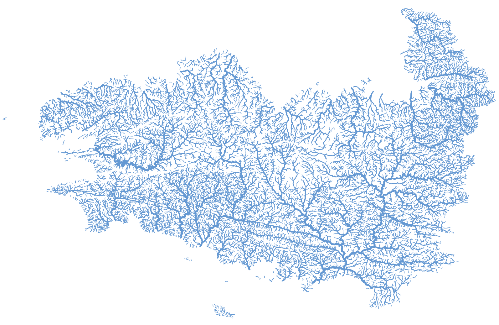
BD Topage corrigée de la Bretagne et de la baie du Mont Saint-Michel
Représentation des tronçons hydrographiques de la Bretagne et des bassins versants de la baie du Mont Saint-Michel extraite de la BD Topage® version 2020. cette couche géographique est corrigée de telle sorte que soit garantie l'unicité du chemin de l'eau de l'amont vers l'aval (suppression des boucles, des canaux, ...).
Simple
- Date (Creation)
- 2022-01-31T15:00:00
- Edition
-
2022
- Citation identifier
- fr-18007003900276-umrsas-topage_topage_bretagne_baie_corrige
- Purpose
-
Cette couche géographique a été réalisée afin d'être utilisée en entrée de différents outils de modélisation hydrologique.
- Status
- Completed
- Point of contact
-
Organisation name Individual name Electronic mail address Role UMR 1069 SAS INRAE - Institut Agro
GéoSAS
Point of contact
- Maintenance and update frequency
- As needed
- Keywords
-
-
Hydrologie
-
- Keywords
-
- Keywords
-
- Keywords
-
-
données ouvertes
-
-
Registre de thème INSPIRE
-
-
Hydrographie
-
- Use limitation
-
Licence ouverte : http://wiki.data.gouv.fr/wiki/Licence_Ouverte_/_Open_Li
cence
- Access constraints
- Other restrictions
- Use constraints
- License
- Other constraints
-
Pas de restriction d’accès public
- Spatial representation type
- Vector
- Denominator
- 5000
- Language
-
fre
- Character set
- UTF8
- Topic category
-
- Inland waters
))
- Reference system identifier
- EPSG:2154
- Reference system identifier
- EPSG / RGF93 / Lambert-93 (EPSG:2154) / 7.4
- Distribution format
-
Name Version ESRI shapefile
ESRI shapefile
- Distributor contact
-
Organisation name Individual name Electronic mail address Role UMR 1069 SAS INRAE - Institut Agro
GéoSAS
Point of contact
- OnLine resource
-
Protocol Linkage Name WWW:DOWNLOAD-1.0-http--download
https://geosas.fr/geoserver/wfs?service=WFS&version=2.0.0&request=GetFeature&typeName=topage:topage_bretagne_baie_corrige&outputFormat=SHAPE-ZIP OGC:WMS
https://geosas.fr/geoserver/topage/ows?service=WMS&request=GetCapabilities topage_bretagne_baie_corrige
WWW:LINK-1.0-http--link
https://geosas.fr/web/ Portail de l information geographique de l UMRSAS
- Hierarchy level
- Dataset
- Statement
-
BD TOPAGE® 2020
Metadata
- File identifier
- 18c10e9f-4ce7-4ffc-ab03-dacd32e29ca8 XML
- Metadata language
-
fre
- Character set
- UTF8
- Hierarchy level
- Dataset
- Date stamp
- 2025-01-07T16:07:16
- Metadata standard name
-
ISO 19115:2003/19139
- Metadata standard version
-
1.0
- Metadata author
-
Organisation name Individual name Electronic mail address Role UMR 1069 SAS INRAE - Institut Agro
Service GéoSAS
Point of contact
)))
